

Today, after a very cold night in Kerang, we packed up and moved a very modest 33 kilometres to the small town of Cohuna, located on Gunbower Creek which is an anabranch of the Murray River. An anabranch (a term used more in Australia than elsewhere) is a section of a river or stream that diverts from the main channel of the watercourse and rejoins it again further downstream. By definition an island, in this case Gunbower Island, is created between the section of river (Gunbower Creek) and the main river (the Murray). Our plan was to explore Gunbower Island over the next couple of days, in addition to having a look around Cohuna, Koondrook (where the Gunbower Creek rejoins the Murray) and Barham, just across the Murray River from Koondrook, in New South Wales.
The small town of Cohuna, with a population of around 2,500, is mainly located on the higher left bank of the Gunbower Creek while our camping ground was on the right bank and directly across the creek from the centre of town. When we arrived at the campsite it was empty so we were able to perfectly position the van for solar recharging purposes. On the first night of our stay another van and a motorhome joined us while on next two nights there were maybe ten or so vehicles in the campground, a number owned by those attending a funeral in town.
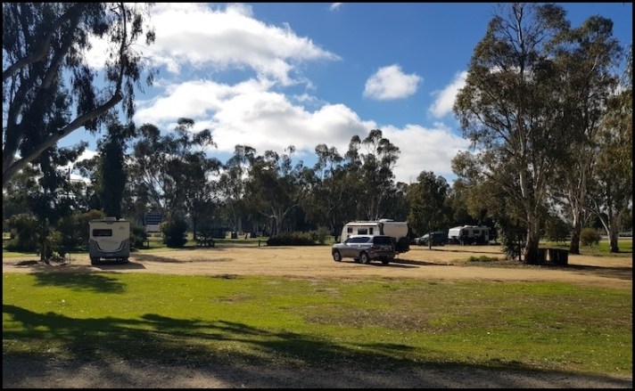
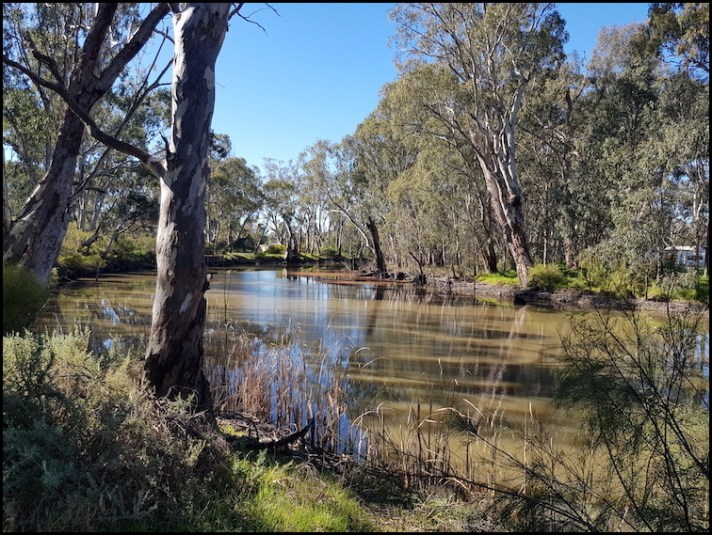
Looking across Gunbower Creek from our campsite to the centre of Cohuna
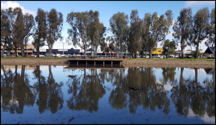
We were able to access the town centre via either a bridge or a weir crossing (on foot), both about 15o metres from where we were parked-up making our campsite extremely convenient for the town’s supermarket, visitor information office and, more importantly, its cafes and thirst quenching establishments.
We decided to start our exploration of the Cohuna area by taking a short walk along Gunbower Creek – nothing too strenuous today! We started out at the nearby weir.
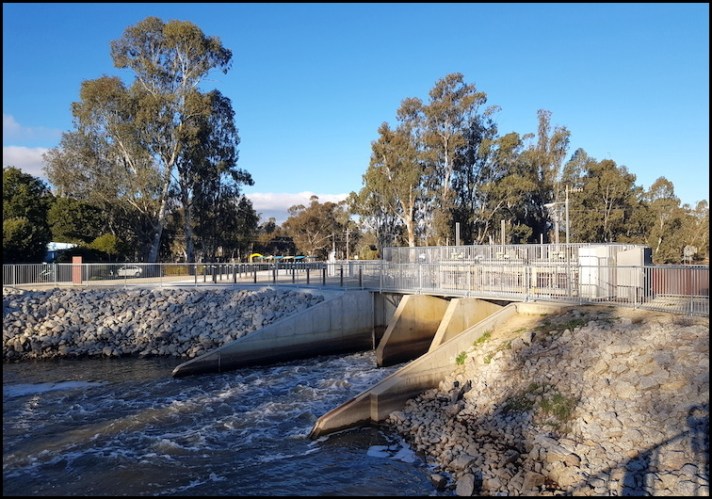
Cohuna Weir
The Cohuna Weir forms part of the massive Torrumbarry Irrigation Areawhich covers some 167,000 hectares on the south (Victorian) side of the Murray River, running from Gunbower (about 20 kilometres to the south of Cohuna) to Nyah just north of Swan Hill, via the Kerang Lakes area which I covered in my last post.
In addition to supporting local agriculture though the reliable provision of water (typically 500,000 ML in a season) the irrigation system also plays an important role in flood mitigation – as it was doing when we visited. I will come back to this, but when we visited water levels in the Gunbower Creek and right across the wetlands area were being kept artificially high to prevent flooding in the township of Koondrook.
The original weir here was constructed in 1908-10 from local redgum timber. It was refurbished in 1957 and replaced in 2005 with the gates now being remote controlled via radio links from Goulburn-Murray Water offices in Cohuna or Kerang.
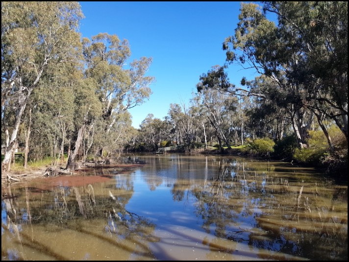
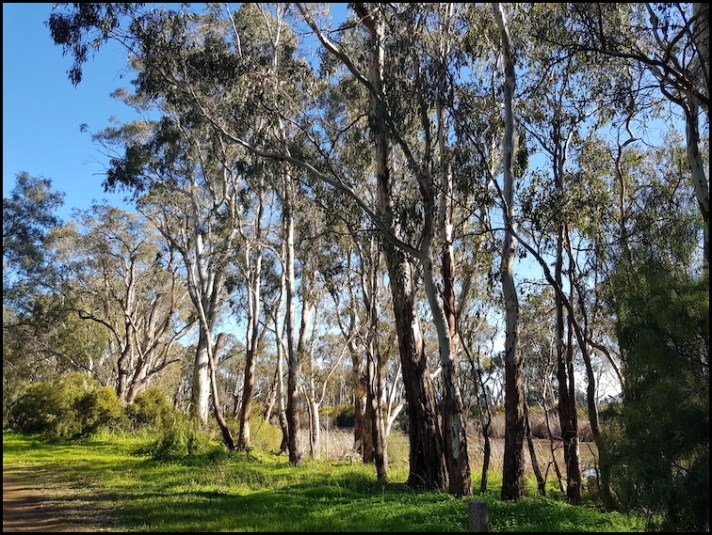
Moving on, although we could not find a sign/marker for our intended walk, there was a clear path heading north along the creek which we followed, enjoying gorgeous creek vistas as we meandered along.
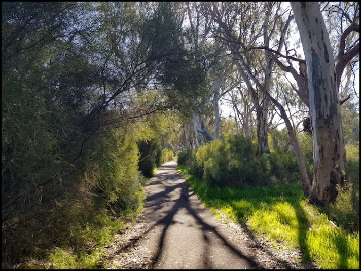
Meandering along Gunbower Creek
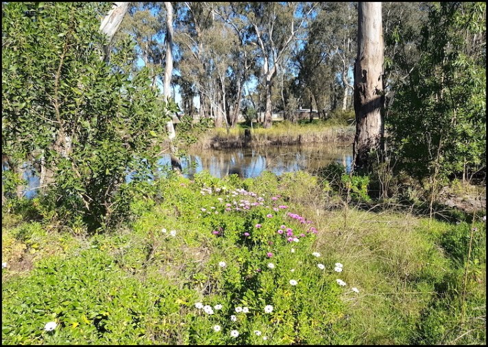
Early spring African daisies along Gunbower Creek
Lovely though this was, after about 500 metres we realised that we were on the wrong side of the creek. As the next crossing was some ten or so kilometres downstream and would have necessitated us trudging through unmarked wetlands and bush to get there we turned back to the weir and our camping area.
On reaching the campground we spotted a sign for the actual planned walk, which we proceeded to do part of.
Across the way from our camping area, there was a beautifully manicured foreshore where we sat for a while, admiring the creek in the beautiful late winter sun. Truth be told, I had nipped across to one of the town’s bakeries and grabbed a couple of naughty pastries which immensely added to our enjoyment of the creek view.
Buoyed on by our sugar hit, we headed on, passing a couple of caravan parks en route and wondering why people would pay about A$50 per night for lesser sites than we had, down the road, for free. I guess that some people would have needed powered sites and many like the certainty of having a pre-arranged place to stay, especially if they are only out on a short trip. Additionally, some consider formal parks more secure than free camps though, in reality, they are not if you are careful in selecting free camps.
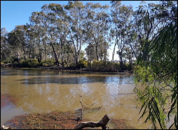
I have digressed. Having passed through the local playing fields we soon rejoined at the creek which was lined with River Red Gums.
The Red Gums here were not that old, likely explained by the proximity of the Cohuna Saw Mill, now owned by the Arbuthnot Sawmills which we will visit in a couple of days, in Koondrook.
From here we headed back towards camp, partially along the creek and partially through the local sports grounds so that we could have a quick look around the small town centre.
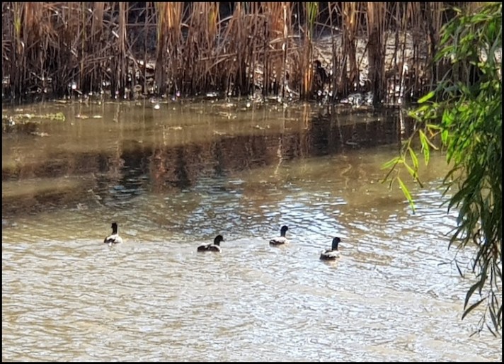
Ducks enjoying the spring sunshine on Gunbower Creek
From a tourist perspective, the natural features of Gunbower Creek and Island are the attractions here while the town serves as a useful base rather than booasting significant tourist sites in its own right. That said, there was sufficient here to attract a few well known musicians. The story goes that John Farnham, a famous and highly successful Australian singer not to my taste, was ‘discovered’ in Cohuna, and he returned in 2002 for a free one-off show. The Bee Gees also played in Cohuna in their early days.
While crossing the bridge to get into town, the first thing we encountered was the town’s water tower.
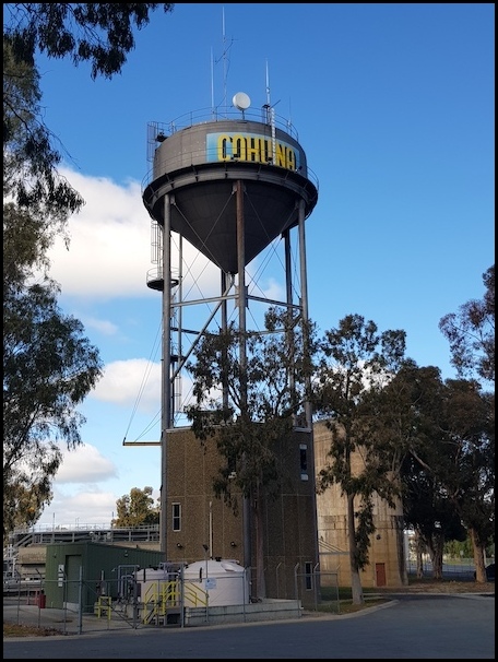
The water tower was erected in 1912. Before that, John McKenzie King was paid £40 a year by the shire to pump water to the town. In 1967 a purification plant with an elevated storage tank was installed.
Across the street, the Cohuna Hotel looked rather unappealing and no longer serves food while the Bower Tavern about 50 metres further down the street looked much more inviting.
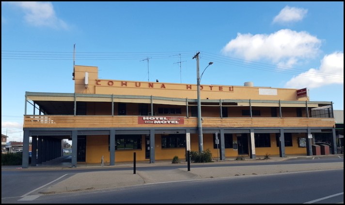
The rather drab looking Cohuna Hotel
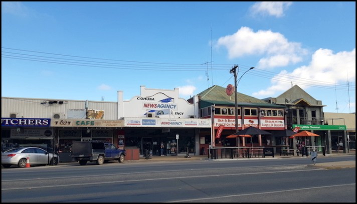
Part of the town’s main street, including the Bower Tavern (second building from the right)
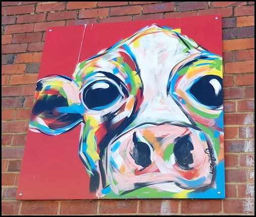
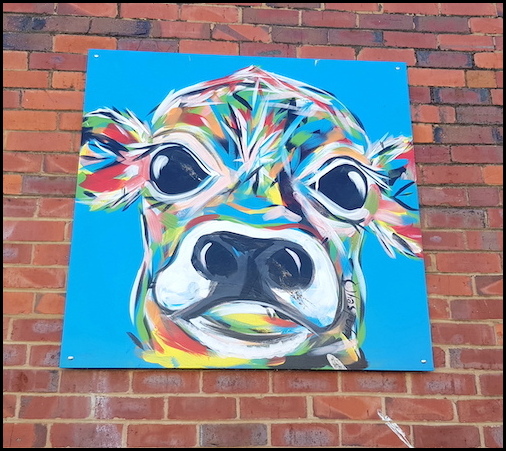
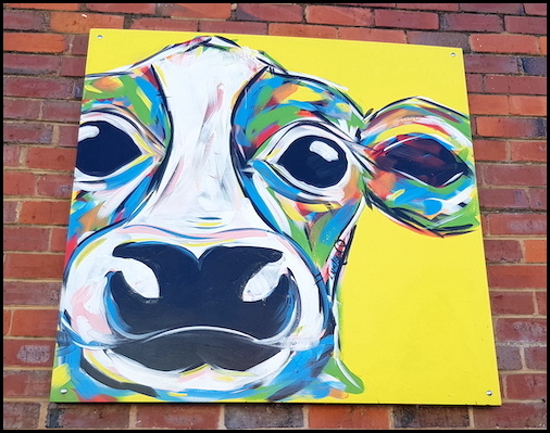
Ever on the lookout for public/ street art, I came across these paintings celebrating the region’s dairy industry. They were accompanied by a plaque with the rather clever notation “In Recognition of Cohuna, LEGENDAIRY capital of the Murray Region”
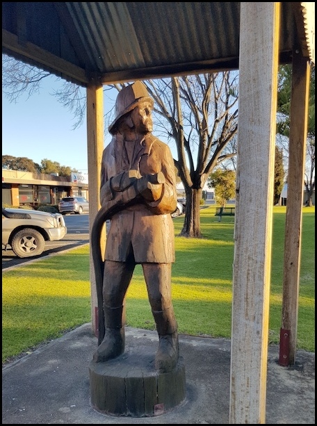
Nearby, in Brigade Park, the site of the town’s former fire station, stands a sculpture of a fireman, carved, using a chainsaw from a local Red Gum. The sculpture commemorates the services of the members of the Cohuna Urban Fire Brigade since its formation in 1922.
Our last stop for today was the tourist information office which I had actually planned on bypassing, having all the information I needed to explore the area. Thankfully I went in, only to be told by the delightful and very helpful lady in command that the Gunbower Island Forest Drive, which I had planned for tomorrow, was closed, as were a couple of walks in Koondrook which I had penciled in for the following day. The closures were due to the high water levels I mentioned earlier in this review. This was very disappointing as I was so looking forward to the drive in particular. After a bit of discussion I left with a plan for a much shortened drive which we actually thoroughly enjoyed the following day. This will be the subject of my next review.
The next review from my Adelaide to Canberra road trip can be found HERE.
Should you wish to follow this road trip from the beginning please start HERE.

Such a pretty area and plenty of freedom camps too.
LikeLike
Lovely views along the water in particular. I’ve never heard of an ‘anabranch’, it must indeed be largely an Australian term 🙂
LikeLiked by 3 people
I’ve never heard the word ‘anabranch’ either.
LikeLiked by 1 person
As I said to Sarah, neither had I .. great to live and learn 🙂
LikeLike
I had never heard of it either – I love learning new things 🙂
LikeLiked by 1 person