
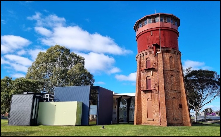
Today we moved on from Sea Lake to the larger rural town of Kerang (population just shy of 4,000) which we will use as a base to explore the Kerang Lakes, tomorrow. Today our primary focus was the mundane activity of shopping to stock up on provisions – there being a Woolworths supermarket in town. While in town we also had a quick look around and a stroll along the Loddon River.
Continue reading “Kerang – A stroll around town and along the Loddon River – Day 311”
Out and about – Tailem Bend to Wellington and back – Day 305 (Pt.1)
Today, we took a short drive down the western side of the Murray River from Tailem Bend to Wellington, via the small hamlet of Jervois, returning to Tailem Bend along the eastern side of the river.
Continue reading “Out and about – Tailem Bend to Wellington and back – Day 305 (Pt.1)”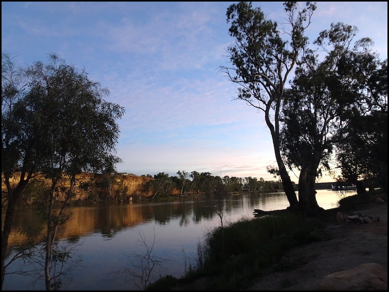
Murray Bridge to Swan Reach – incorporating the disposal of certain caravan waste – Day 300
On completion of our short visit to Murray Bridge and having enjoyed walking along the river it was time to move on to Swan Reach hoping that we would snag a prime camping site right by the river.
Continue reading “Murray Bridge to Swan Reach – incorporating the disposal of certain caravan waste – Day 300”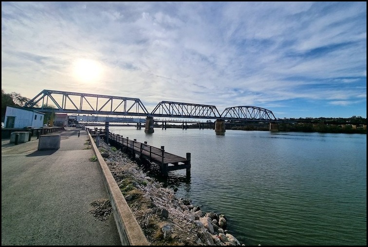
A Walk Around Murray Bridge – Day 299 (Pt 2.)
The city of Murray Bridge is situated on the lower reaches of the Murray River – the third longest navigable river in the world, after the Amazon and the Nile. It is about 80 kms from the South Australian state capital of Adelaide. Surprise, surprise its name derives from a bridge built across the River Murray in 1879. The city is a typical rural hub surrounded by a major agricultural area focusing on the dairy industry, chicken raising, pig breeding and vegetable growing. From a tourist perspective the main attractions are paddle steamer trips along the river and a visit to the nearby Monarto Safari Park.
Continue reading “A Walk Around Murray Bridge – Day 299 (Pt 2.)”
The Black Wallaby Loop Track and Googong Lookout – Googong Foreshores
The Black Wallaby Loop Track is a relatively easy 2.6 kms loop walk within Googong Foreshores reserve and for me has the largest bang for buck, in terms of scenery, of all the walks in the reserve. This bang for buck can be increased if you vary the walk slightly to include a visit to the Googong Lookout and return via the tail end of the Bradleys Creek walk, rather than returning via the bitumen road, as outlined in the reserve’s brochure. Opting for this variation (covered in this post) will add 1.8 kms to the walk making it 4.4 kms, without increasing the walk’s difficulty rating. Allow at least 1.5 hrs for the extended walk.
Continue reading “The Black Wallaby Loop Track and Googong Lookout – Googong Foreshores”
Cascades Walk – Googong Foreshores
At about 200 metres return this is the shortest and easiest, noting that there are some steps, walk in the Googong Foreshores reserve. If you just walk in and enjoy the views then you can easily complete the walk in 15 minutes.
Continue reading “Cascades Walk – Googong Foreshores”
London Bridge, Googong – Walk via Drawdown Crossing
It is amazing to think that millions of years ago, around 420 million to be more precise, the London Bridge, Googong area was part of the ocean floor. As the ocean receded the arch, which would become known as the London Bridge Arch, slowly formed by water leaching through the fossiliferous limestone, enlarging cracks, until a passage big enough to let the Burra Creek through was created. The arch reached its present form about 20,000 years ago.
Continue reading “London Bridge, Googong – Walk via Drawdown Crossing”
Giorgio’s Sandwash Track – Woodstock Nature Reserve
While enjoying the amazing views down onto the Murrumbidgee River and the surrounding countryside from Shepherd’s Lookout I noticed a formed track running along the northern back of the river, terminating at an almost 90 degree bend in the river. A quick check confirmed that this was an official walking track – Giorgio’s Sandwash Track. Continue reading “Giorgio’s Sandwash Track – Woodstock Nature Reserve”
Uriarra Loop Walk
Having enjoyed a bird’s eye view of the Murrumbidgee River and the surrounding hills and countryside from Shepherd’s Lookout and the Molonglo River Track as I made my way down from the Lookout to the Molonglo River it was time for a gentler, though in part undulating, walk at river level. Continue reading “Uriarra Loop Walk”
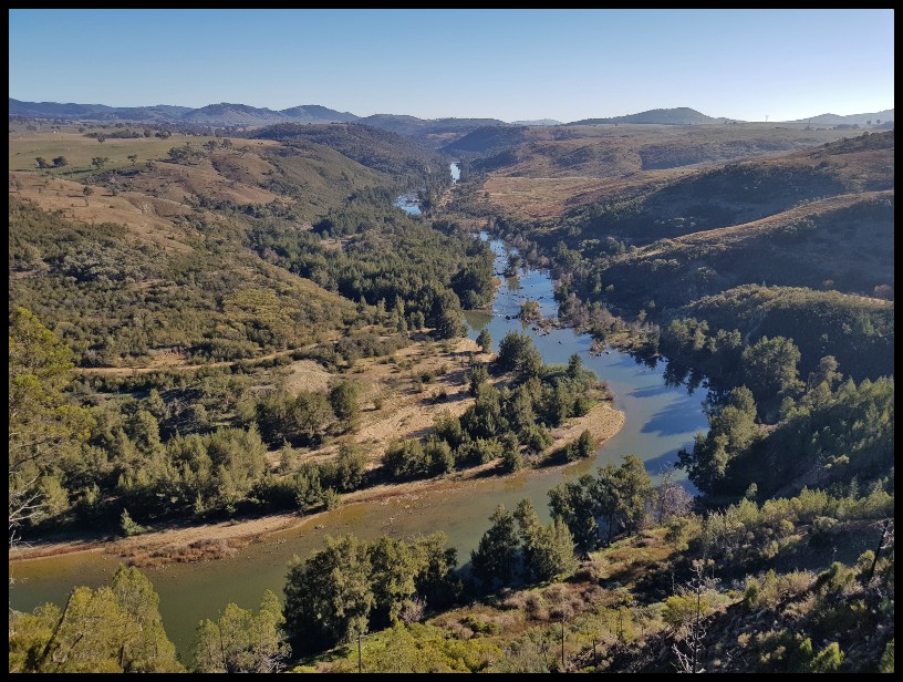
Molonglo River Track (Crossing) – By Way of Shepherd’s Lookout
Notwithstanding the title of this review a primary focus of this walk is the Murrumbidgee River, just before it leaves the Australian Capital Territory (ACT) on its long path to Balranald where it joins with the Murray River. This in turn takes its waters to the Indian Ocean, south of Adelaide, in South Australia. Continue reading “Molonglo River Track (Crossing) – By Way of Shepherd’s Lookout”
