
After enjoying the Winter Blues Festival for a few hours yesterday afternoon we spent the next couple of days wandering around the border towns of Echuca (Victoria) and Moama (New South Wales). This morning, we started off with Moama and its monthly market. Given that the Winter Blues Festival was still in full swing it came as no surprise that the market was particularly busy when we visited.
Continue reading “Moama, New South Wales – Day 317”
Barham – Koondrook on the Murray – Day 315
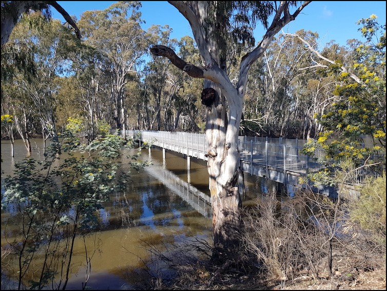
Today’s plan was to explore the northern part of Gunbower Island, immediately to the south of the small town of Koondrook, via a couple of walks and then have a look around the border towns of Koondrook and Barham. As mentioned in my previous entry, we were advised that our intended walks were off limits as the Gunbower Creek had flooded in early 2023 and the walking tracks were still, in late July, under water. Notwithstanding this, we made our way to the point where I had planned on starting the walks in anticipation that a some part of the tracks might be open.
Continue reading “Barham – Koondrook on the Murray – Day 315”
A look around Cohuna, by Gunbower Creek – Day 313
Today, after a very cold night in Kerang, we packed up and moved a very modest 33 kilometres to the small town of Cohuna, located on Gunbower Creek which is an anabranch of the Murray River. An anabranch (a term used more in Australia than elsewhere) is a section of a river or stream that diverts from the main channel of the watercourse and rejoins it again further downstream. By definition an island, in this case Gunbower Island, is created between the section of river (Gunbower Creek) and the main river (the Murray). Our plan was to explore Gunbower Island over the next couple of days, in addition to having a look around Cohuna, Koondrook (where the Gunbower Creek rejoins the Murray) and Barham, just across the Murray River from Koondrook, in New South Wales.
Continue reading “A look around Cohuna, by Gunbower Creek – Day 313”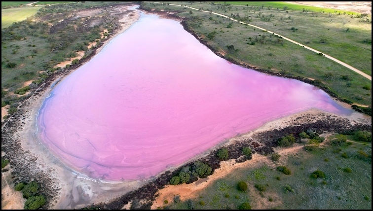
The Murray – Sunset National Park – More Pink Lakes – Day 308
The area known as Pink Lakes, within the 6,330 square kms Murray – Sunset National Park, consists of four lakes – Crosbie, Becking, Kenyon and Hardy. Yesterday we went on a walk which covered Lakes Crosbie and Kenyon. Today we will, through a combination of driving and walking, explore Lakes Becking and Hardy.
Continue reading “The Murray – Sunset National Park – More Pink Lakes – Day 308”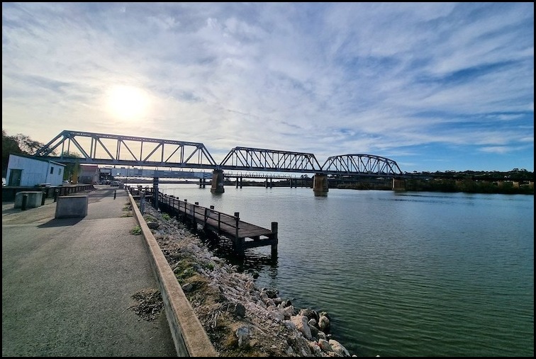
A Walk Around Murray Bridge – Day 299 (Pt 2.)
The city of Murray Bridge is situated on the lower reaches of the Murray River – the third longest navigable river in the world, after the Amazon and the Nile. It is about 80 kms from the South Australian state capital of Adelaide. Surprise, surprise its name derives from a bridge built across the River Murray in 1879. The city is a typical rural hub surrounded by a major agricultural area focusing on the dairy industry, chicken raising, pig breeding and vegetable growing. From a tourist perspective the main attractions are paddle steamer trips along the river and a visit to the nearby Monarto Safari Park.
Continue reading “A Walk Around Murray Bridge – Day 299 (Pt 2.)”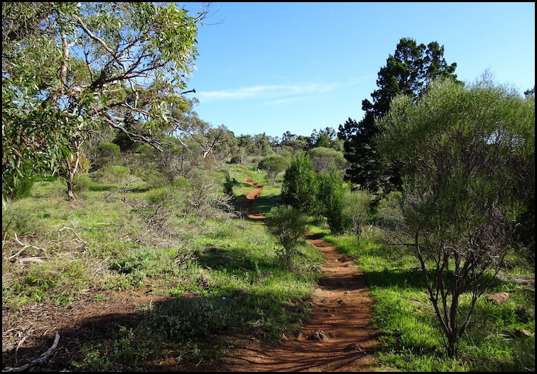
Kinchina Conservation Park and Rocky Gully Wetland – Murray Bridge – Day 299 (Pt 1.)
This morning, we decided to go for a walk in Kinchina Conservation Park, less than five kilometres from the centre of Murray Bridge. The park map shows a plethora of marked walks covering both the northern and southern sections of the 414-hectare park. Instead of following any these walks, we decided to explore the park more extensively with a concocted route that covered about 70% of the marked walks in terms of distance, including both the northern and southern sections of the park.
Continue reading “Kinchina Conservation Park and Rocky Gully Wetland – Murray Bridge – Day 299 (Pt 1.)”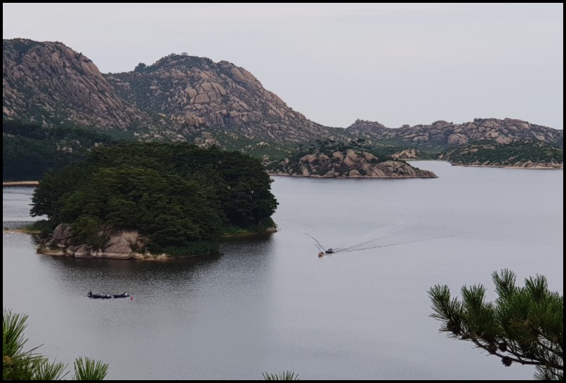
Samil Lagoon/ Lake – Mt Kumgang
En route back to our hotel from a spectacular hike to the Kuryong Falls we made a stop for a short walk to a viewing platform over Samil Lake.
Samil Lake is an 80 hectare freshwater lake, 9-13 metres deep, within the Mount Kumgang Tourist Region, in the south-eastern part of North Korea. It sits about 2 kilometres from the coast of the East Sea of Korea ( the Sea of Japan to non-Koreans) and 9 kilometres north-west of the border with South Korea.
Continue reading “Samil Lagoon/ Lake – Mt Kumgang”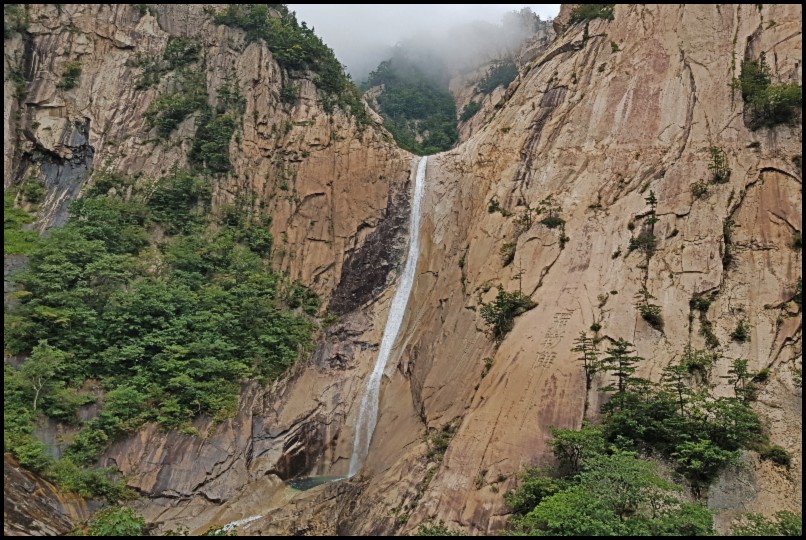
Kuryong Falls – Mt Kumgang Walk
Mount Kumgang, or the Kumgang Mountains, is a spectacular and stunningly beautiful mountain range, also referred to as the diamond or the thousand peak mountains. The mountains are located in the South East corner of North Korea, bordering with South Korea, on the other side of the infamous demilitarised zone. Between 2002 and 2008 hundreds of thousands of tourists from South Korea, in particular, visited the area. Since then it has very much reverted back the ‘the unseen North Korea’ visited by very few international tourists. While the mountains are a hikers delight and one could easily spend weeks here we were limited to an afternoon’s hiking to Kuryong Falls and a short visit to the Samilpo Lake (see seperate review) – but what a delightful afternoon it was.
Continue reading “Kuryong Falls – Mt Kumgang Walk”
Shoreline Walk – Return via Western Foreshores Walk (part) – Googong Foreshores
The Shoreline Walk is a popular and easy four kilometres return lineal walk along part of the western foreshore of the Googong reservoir, within the Googong Foreshores reserve. Rather than return via the same route I continued along Shannons Inlet (otherwise the turnaround point) until I connected with the management track and the Western Foreshores walk and used that track to complete my walk. This added nearly a kilometre to the walk’s length and sightly increased its difficulty but it let me walk through, and enjoy, an area of open grassland with sweeping views of the countryside, the reservoir and the Queanbeyan escarpment to the east. It also gave me a less picturesque view of suburbia housing in Googong village, off to my left, as I approached the end of the walk. Give yourself at least an hour and a half to enjoy this walk.
Continue reading “Shoreline Walk – Return via Western Foreshores Walk (part) – Googong Foreshores”
Bradleys Creek Walk – Googong Foreshores
Bradleys Creek walk, at 14.2 kms return, is the longest and most difficult walk in the northern section of the Googong Foreshores reserve. It is also one of the most rewarding in terms of views and in getting a good cardio work-out. It requires a reasonable level of fitness and, with that, will take around four hours (plus stops) to complete.
Continue reading “Bradleys Creek Walk – Googong Foreshores”