

The Black Wallaby Loop Track is a relatively easy 2.6 kms loop walk within Googong Foreshores reserve and for me has the largest bang for buck, in terms of scenery, of all the walks in the reserve. This bang for buck can be increased if you vary the walk slightly to include a visit to the Googong Lookout and return via the tail end of the Bradleys Creek walk, rather than returning via the bitumen road, as outlined in the reserve’s brochure. Opting for this variation (covered in this post) will add 1.8 kms to the walk making it 4.4 kms, without increasing the walk’s difficulty rating. Allow at least 1.5 hrs for the extended walk.
Continue reading “The Black Wallaby Loop Track and Googong Lookout – Googong Foreshores”
Cascades Walk – Googong Foreshores
At about 200 metres return this is the shortest and easiest, noting that there are some steps, walk in the Googong Foreshores reserve. If you just walk in and enjoy the views then you can easily complete the walk in 15 minutes.
Continue reading “Cascades Walk – Googong Foreshores”
An Evening Promenade – Jongdok Islet, Wonsan
Wonsan has been an important port since it was established in around 1880, primarily for trade with Japan. In 1919, during their occupation of the Korean Peninsula, the Japanese further developed the port and built a causeway/breakwater out to Jangdok Islet on which they built a lighthouse – for the protection of the harbour and shipping, mainly their own.
Continue reading “An Evening Promenade – Jongdok Islet, Wonsan”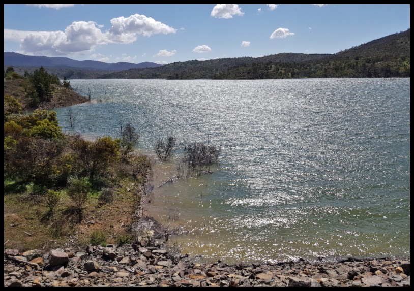
The Honyong-Cotter Track, Cotter Reserve
Having completed the Mt McDonald Summit walk by just after 11am my plan was an early lunch break by the Cotter River, down by the Dam, and then to do the slightly longer Bullen Track walk to the Cotter Caves which, due to vandalism, I had heard were no longer open to the public, but thinking that the walk would still be worthwhile.
Continue reading “The Honyong-Cotter Track, Cotter Reserve”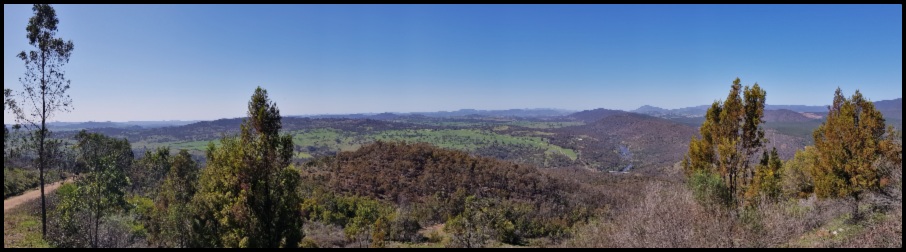
Mt McDonald and the Cotter Catchment Lookout Walk
On a recent walk into the former Sherwood Homestead I had views of Mt McDonald in the distance – one such view depicted below. This reminded me that while I had walked part-way up the mountain, to the Cotter Catchment Lookout, I had not yet visited the top. To-day’s early spring walk would put that right and I would make a slight deviation on the return to re-visit the dam/catchment lookout. As it turned out, this was one of the best walks with the best views for the effort required that I have done in a while – highly recommended.
Continue reading “Mt McDonald and the Cotter Catchment Lookout Walk”
Tin Hut Dam Walk – Googong Foreshore
At around 1.5 kilometres (or just over two kilometres if take a short side trip for a look at the Queanbeyan River and the lower reaches of the Googong Reservoir as I did) the walk around Tin Hut Dam is one of the shortest and easiest walks in the Googong Foreshore reserve. While there is no defined path along the western side of the dam, rather you walk through open reserve close to the bank of the dam, you cannot get lost.
Continue reading “Tin Hut Dam Walk – Googong Foreshore”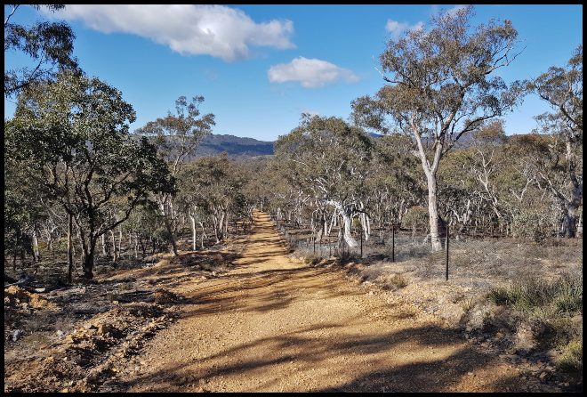
Queanbeyan River Walk – Googong Foreshores
Do not be fooled or lulled into a false sense of security by the name of this walk (or the associated Queanbeyan River Loop Ride). This is no genteel promenade along the banks of the Queanbeyan River but rather a hard eighteen kilometres hike up and down park management trails which, apart from at two points, is not within sight of the river. Don’t let that put you off though, if you have a reasonable level of fitness this is a very worthwhile walk.
Continue reading “Queanbeyan River Walk – Googong Foreshores”
London Bridge Walk – via London Bridge Homestead
I have done this circular walk a number of times and prefer doing it in an anti-clockwise direction, contrary to the recommended (signposted) route. Don’t worry you won’t get lost and it’s a great walk in either direction, I just prefer to walk the longer, less steep, downhill section first-up with a shorter steeper finish.
Continue reading “London Bridge Walk – via London Bridge Homestead”
London Bridge, Googong – Walk via Drawdown Crossing
It is amazing to think that millions of years ago, around 420 million to be more precise, the London Bridge, Googong area was part of the ocean floor. As the ocean receded the arch, which would become known as the London Bridge Arch, slowly formed by water leaching through the fossiliferous limestone, enlarging cracks, until a passage big enough to let the Burra Creek through was created. The arch reached its present form about 20,000 years ago.
Continue reading “London Bridge, Googong – Walk via Drawdown Crossing”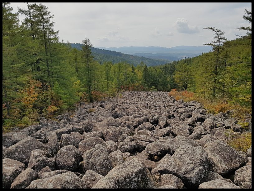
Pujon Stone River and Revolutionary Site
After what turned out to be a four hour drive from Hamhung (as opposed to the expected three), due to problems with one of our buses we arrived at the entrance to Mt. Ongryon park in the Pujon Highlands, one of the ‘Eight Great Sights of Korea’. Here we met our local guide for our short walk to the Stone River and to some very special trees. The bus trip, which I have written about in two separate reviews (Part A HERE and Part B HERE), while at times gruelling, was scenically beautiful and gave us some insight into everyday life (road maintenance in particular!) in this remote and rarely visited part of North Korea.
Continue reading “Pujon Stone River and Revolutionary Site”