

Today’s plan was to explore the northern part of Gunbower Island, immediately to the south of the small town of Koondrook, via a couple of walks and then have a look around the border towns of Koondrook and Barham. As mentioned in my previous entry, we were advised that our intended walks were off limits as the Gunbower Creek had flooded in early 2023 and the walking tracks were still, in late July, under water. Notwithstanding this, we made our way to the point where I had planned on starting the walks in anticipation that a some part of the tracks might be open.
Continue reading “Barham – Koondrook on the Murray – Day 315”
A drive around The Kerang Lakes – Day 312
Between Kerang and Lake Boga (about 40 kilometres north of Kerang) lie over fifty lakes of varying size, some with water, some dry. Collectively the lakes are referred to as The Kerang Lakes and today we visited a small number of the more accessible and thus more popular of these lakes.
Continue reading “A drive around The Kerang Lakes – Day 312”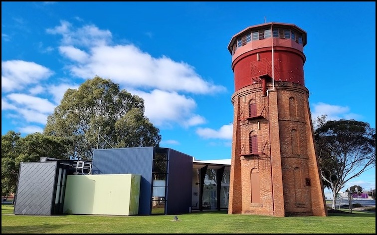
Kerang – A stroll around town and along the Loddon River – Day 311
Today we moved on from Sea Lake to the larger rural town of Kerang (population just shy of 4,000) which we will use as a base to explore the Kerang Lakes, tomorrow. Today our primary focus was the mundane activity of shopping to stock up on provisions – there being a Woolworths supermarket in town. While in town we also had a quick look around and a stroll along the Loddon River.
Continue reading “Kerang – A stroll around town and along the Loddon River – Day 311”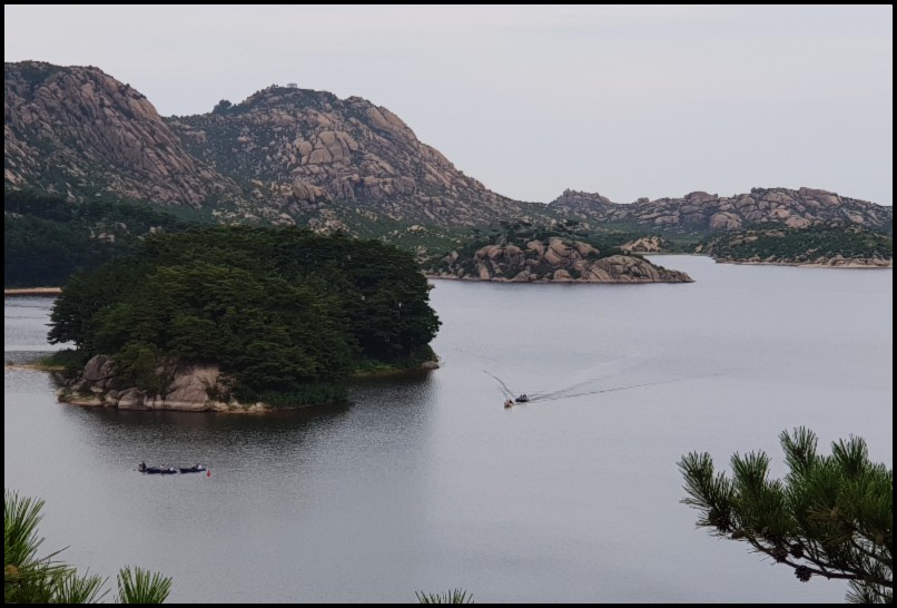
Samil Lagoon/ Lake – Mt Kumgang
En route back to our hotel from a spectacular hike to the Kuryong Falls we made a stop for a short walk to a viewing platform over Samil Lake.
Samil Lake is an 80 hectare freshwater lake, 9-13 metres deep, within the Mount Kumgang Tourist Region, in the south-eastern part of North Korea. It sits about 2 kilometres from the coast of the East Sea of Korea ( the Sea of Japan to non-Koreans) and 9 kilometres north-west of the border with South Korea.
Continue reading “Samil Lagoon/ Lake – Mt Kumgang”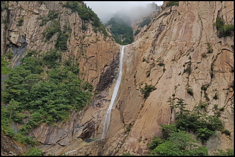
Kuryong Falls – Mt Kumgang Walk
Mount Kumgang, or the Kumgang Mountains, is a spectacular and stunningly beautiful mountain range, also referred to as the diamond or the thousand peak mountains. The mountains are located in the South East corner of North Korea, bordering with South Korea, on the other side of the infamous demilitarised zone. Between 2002 and 2008 hundreds of thousands of tourists from South Korea, in particular, visited the area. Since then it has very much reverted back the ‘the unseen North Korea’ visited by very few international tourists. While the mountains are a hikers delight and one could easily spend weeks here we were limited to an afternoon’s hiking to Kuryong Falls and a short visit to the Samilpo Lake (see seperate review) – but what a delightful afternoon it was.
Continue reading “Kuryong Falls – Mt Kumgang Walk”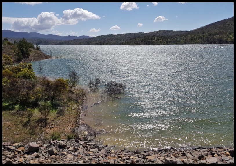
The Honyong-Cotter Track, Cotter Reserve
Having completed the Mt McDonald Summit walk by just after 11am my plan was an early lunch break by the Cotter River, down by the Dam, and then to do the slightly longer Bullen Track walk to the Cotter Caves which, due to vandalism, I had heard were no longer open to the public, but thinking that the walk would still be worthwhile.
Continue reading “The Honyong-Cotter Track, Cotter Reserve”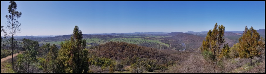
Mt McDonald and the Cotter Catchment Lookout Walk
On a recent walk into the former Sherwood Homestead I had views of Mt McDonald in the distance – one such view depicted below. This reminded me that while I had walked part-way up the mountain, to the Cotter Catchment Lookout, I had not yet visited the top. To-day’s early spring walk would put that right and I would make a slight deviation on the return to re-visit the dam/catchment lookout. As it turned out, this was one of the best walks with the best views for the effort required that I have done in a while – highly recommended.
Continue reading “Mt McDonald and the Cotter Catchment Lookout Walk”
Tin Hut Dam Walk – Googong Foreshore
At around 1.5 kilometres (or just over two kilometres if take a short side trip for a look at the Queanbeyan River and the lower reaches of the Googong Reservoir as I did) the walk around Tin Hut Dam is one of the shortest and easiest walks in the Googong Foreshore reserve. While there is no defined path along the western side of the dam, rather you walk through open reserve close to the bank of the dam, you cannot get lost.
Continue reading “Tin Hut Dam Walk – Googong Foreshore”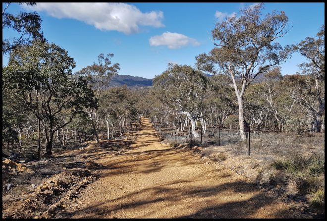
Queanbeyan River Walk – Googong Foreshores
Do not be fooled or lulled into a false sense of security by the name of this walk (or the associated Queanbeyan River Loop Ride). This is no genteel promenade along the banks of the Queanbeyan River but rather a hard eighteen kilometres hike up and down park management trails which, apart from at two points, is not within sight of the river. Don’t let that put you off though, if you have a reasonable level of fitness this is a very worthwhile walk.
Continue reading “Queanbeyan River Walk – Googong Foreshores”
London Bridge Walk – via London Bridge Homestead
I have done this circular walk a number of times and prefer doing it in an anti-clockwise direction, contrary to the recommended (signposted) route. Don’t worry you won’t get lost and it’s a great walk in either direction, I just prefer to walk the longer, less steep, downhill section first-up with a shorter steeper finish.
Continue reading “London Bridge Walk – via London Bridge Homestead”