Do not be fooled or lulled into a false sense of security by the name of this walk (or the associated Queanbeyan River Loop Ride). This is no genteel promenade along the banks of the Queanbeyan River but rather a hard eighteen kilometres hike up and down park management trails which, apart from at two points, is not within sight of the river. Don’t let that put you off though, if you have a reasonable level of fitness this is a very worthwhile walk.
On heading out to the trail-head for the walk my plan was to walk the slightly longer (19.7 kilometres) Queanbeyan River Loop Ride which is, after an initial 5 kilometre linear walk, a circular walk requiring two crossings of the Queanbeyan River. While, based on its name, this was obviously intended as a cycle ride the majority of walkers also do this as a walk, such that they are not covering the same ground twice.
As there are no bridges across the river whether or not one can cross it is dependent on the water level and its flow rate. Given that there had been significant rain in the month before I did the walk I was concerned that I would not be able to safely cross the river at either or both crossing points. My backup, in this eventuality, was the linear Queanbeyan River Walk.
Both walks are within the Googong Foreshores reserve which was created around the Googong Dam and reservoir to protect the primary catchment area of one of Canberra and Queanbeyan’s main water supplies.
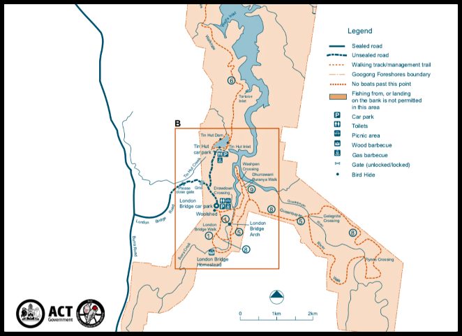
There are two access points to the Googong Foreshores reserve with this walk being accessed via the southern entrance (noting that there is no vehicular access within the reserve between the Dam at the northern access and the trail-head for this walk in the south – you have a 20 kilometres walk option!). It is important to remember that this is not a 24hr access park and that the southern access gate does not open until 8.00am and is locked again at 5.00pm in non-daylight savings time and 7.00pm in daylight savings time. The northern gate stays open one hour longer in both periods.
The starting point for this walk (and most other southern walks) is the London Bridge car park. Why that name will become clear shortly. The car park is about 40 kilometres (45 minutes drive) from Canberra CBD. At the car park, in addition to full picnic/bbq facilities and toilets, there is an old woolshed and some shearers quarters which I have referred to in my London Bridge via Drawdown Crossing Walk.
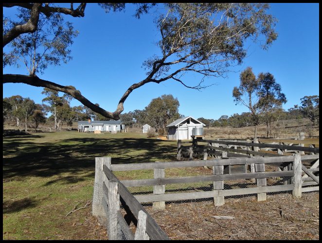
Today there was no time for lingering so after a quick visit to the toilet I ‘signed in’ for the walk at the register depicted below. I cannot over-stress how important it is to sign in, especially for longer walks in this area. While the walk involves no rock clambering, and unless you take shortcuts the track is well formed, it is still all to easy to slip and twist an ankle, or worse, especially at the river crossings and on any particular day, especially outside weekends, you will likely be the only person/group on the walk. I found there to be only intermittent mobile coverage at the higher points along this walk with no reception at either river crossing.
Leaving the car park I headed for London Bridge (about 800 metres on clearly identifiable path with good signage), the primary attraction in the southern part of the reserve, though still pretty much unknown even amongst Canberra residents.
London Bridge is a natural limestone arch across the Burra Creek which began life about 420 million years ago when sediment and coral remains were deposited on the then ocean bed. In the intervening years the ocean receded and the bridge’s arch was formed by water slowly leaching through the limestone until it reached its present size about 20,000 years ago.
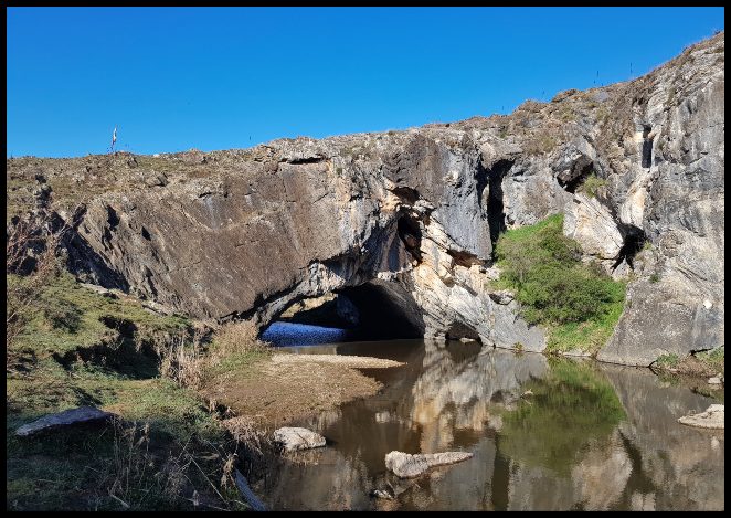

You can find more details on the bridge on my seperate post HERE and on the nearby London Bridge Homestead, which is not on this walk, HERE. Suffice it to say here that unlike its namesake in London, this London Bridge has never fallen down nor has it suffered any other of the depredations that have befallen the U.K. version!
Having crossed London Bridge which, in the absence of any railings, you could easily do without realising it was a bridge with an arch below, I took my first slight detour from the ‘official walk’. Rather than head straight across some pasture towards the path I could see in the distance, I veered left (north) and went down to the creek level to have a look at the arch and then continued along the Burra Creek in a northerly direction.

Having enjoyed walking along the creek for a couple of hundred metres I took a sharp right turn for a few hundred metres ( with 30 metres ascent) of bush bashing until I connected with the official track/management road. While it would have been impossible to get lost in this instance with the track ahead of me and the creek behind me I only take short-cuts like this in winter when the chances of threading on a snake are minimal and when I have an offline map with global positioning activated.
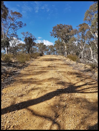
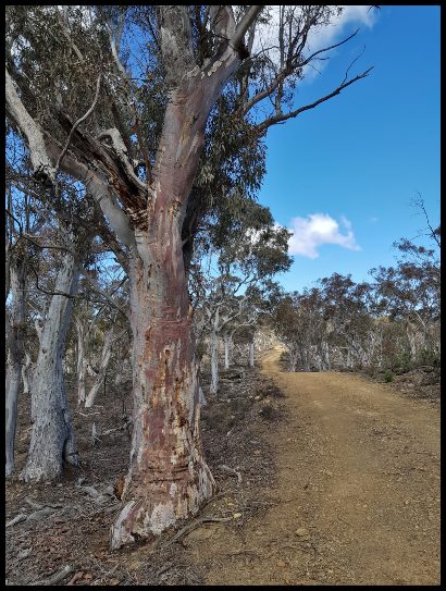
Reaching the management road, on some maps referred to as the Dhurrawarri Buranya Walk, I turned left and followed the undulating track (with one fairly steep descent – a taste of things to come) for another few hundred metres prior to taking my second and final detour from the official track. In doing so, I again swung right and took to the bush, for about 500 metres, broadly following the fence line (with one deviation leftwards to avoid a steep decline/incline ) which separates the Googong Foreshores reserve from the Burra Creek Nature Reserve, a reserve I had never heard of.
This short-cut possibly saved me 500 metres walking but as it was steeper than the longer option and there was no path to follow it probably saved me no time. Had I stayed on the formed track, as I did on my return, I would have come to a T intersection with clear directions to turn right along the N.Urialla Trail.

As it was, I emerged from the bush along this trail, at an entry gate to Burra Creek Nature Reserve, having now gained about 100 metres in altitude since leaving London Bridge. In the absence of any visible signage to the contrary, and for some reason without checking my map, I assumed that I should enter the Burra Creek Reserve and did so. Having walked along a fairly flat track for about 500 metres I felt that the walk was too easy so checked on my offline map and quickly ascertained that I should have turned left at the entry gate.
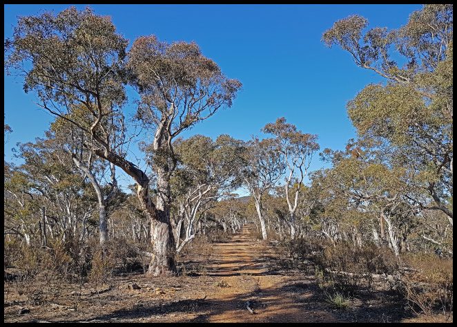
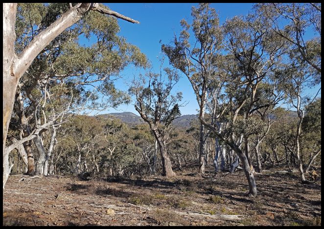
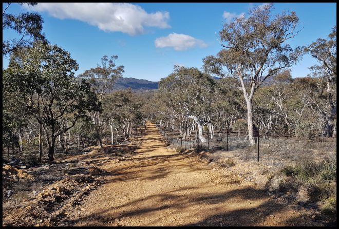
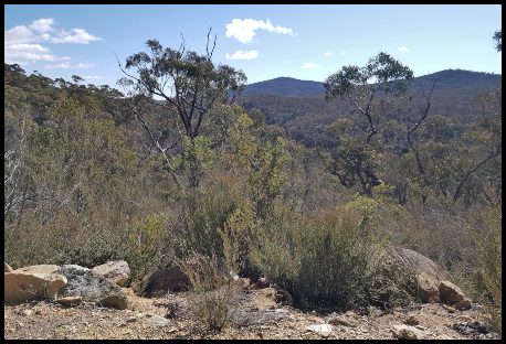
Retracing my steps, I rejoined the correct track and continued onwards along the fence-line, now getting wonderful views ahead and out across the river valley, on my left, to distant hills – those landscape views that photographs don’t do justice to.
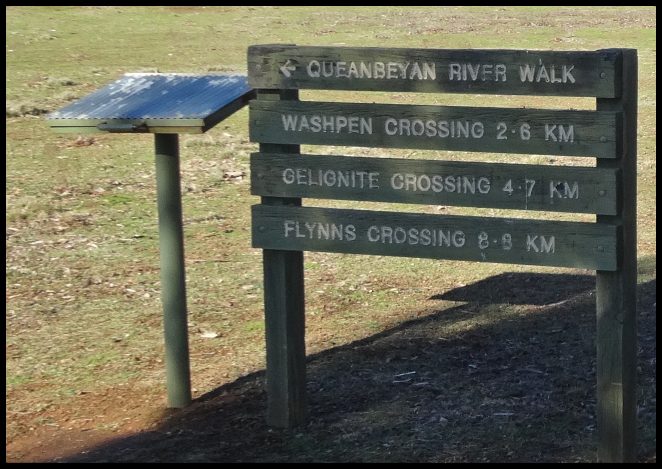
After just over a kilometre of relatively gentle though undulating walking I started on a steep decline to the Queanbeyan River at Gelignite Crossing, loosing the 100 metres altitude I had gained in around 500 metres.


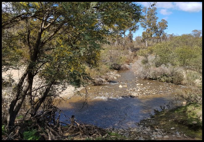
On arrival at the Gelignite Crossing (why it is so called I do not know) I pottered around admiring the view and enjoying the sound of the river gushing by for ten minutes or so.
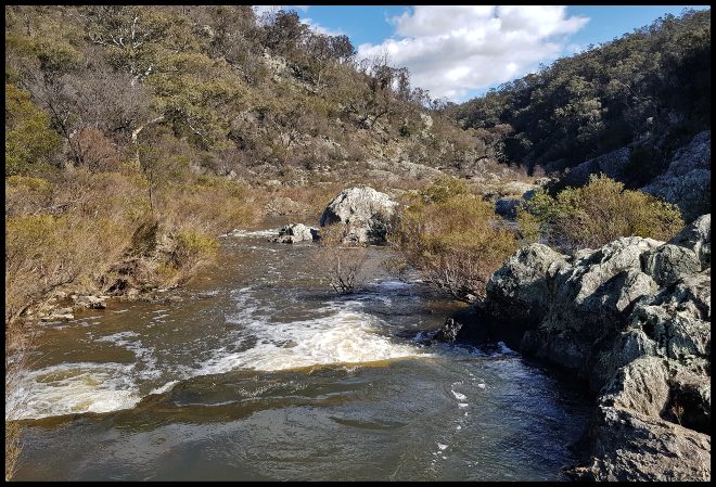


In this time I also, sadly, concluded that I could not safely cross the river so on reaching Flynn’s Crossing at the outward end of the River Walk I would return via the way I had arrived rather then crossing the river there and following the Loop Walk.
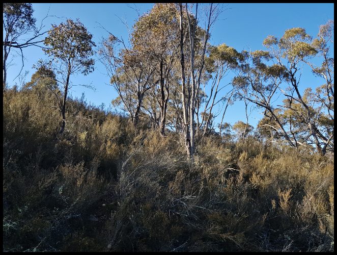
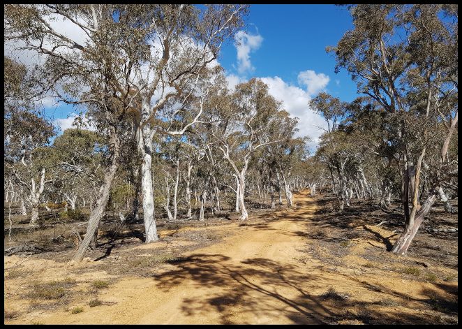
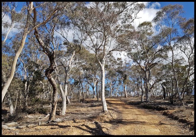
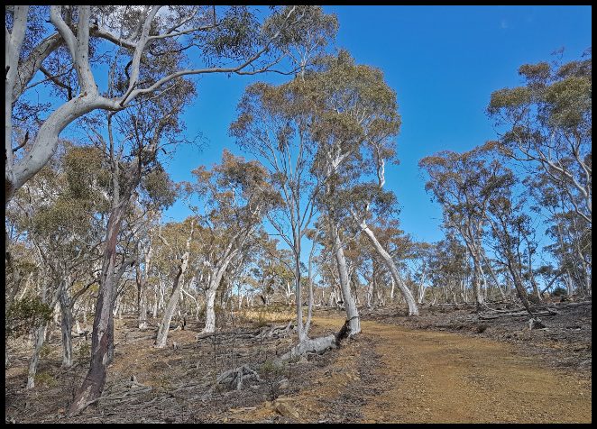
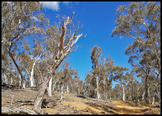
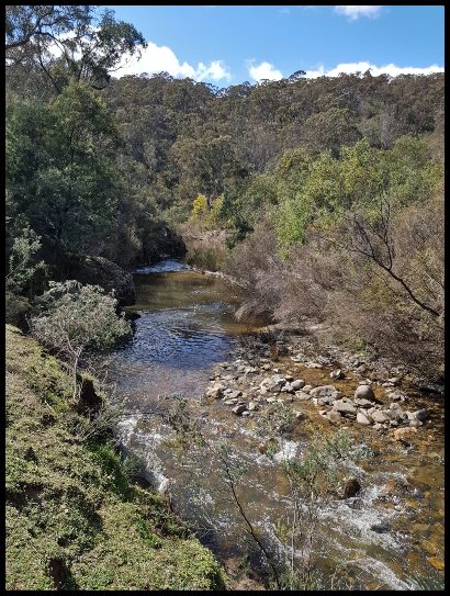
Continuing on towards Flynn’s Crossing the management road moved away from the river and the steep ups and downs continued on what is, by far, the most difficult walk in the Googong Foreshores reserve and one of the hardest in the Canberra Region. On the positive side the scenic views across the river valley and the bush scenery made up of the challenging track.


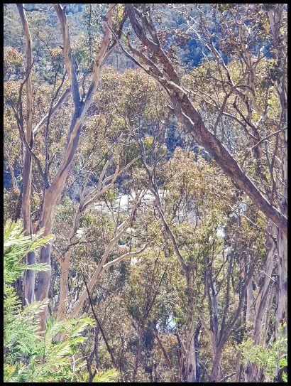
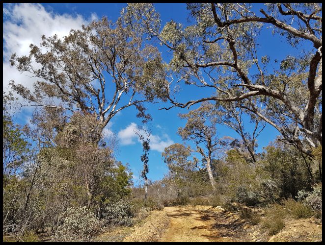
After the about 45 minutes I the highest point on the track and began the final decent to Flynn’s Crossing – a drop in altitude of about 120 metres but over a longer distance than the drop down to Gelignite Crossing. Along this last section of the walk I really enjoyed the beautiful eucalyptus trees made all the more impressive by the winter sun reflecting off the silver barks. Enough to temporarily take my mind of the return walk!


Inspecting the river on arrival, I concluded that even though it was moving relatively fast it was passable (having removed boots and socks) but because I would not be able to cross it again at the Gelignite Crossing I could not proceed.
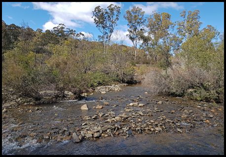
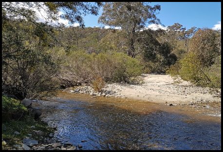
While I didn’t cross the river I did remove my boots and socks and had a quick paddle in the water, and I mean quick, as the water was absolutely freezing notwithstanding the very pleasant 15 degrees centigrade I had enjoyed along my walk. I hung around the crossing for about half an hour admiring the river and relishing the serenity while enjoying my lunch, which I had brought with me.
Having recharged my batteries I set off on the return walk hoping that this time I might see some more animal life than I had on the way in, when I saw only a kangaroo and a few birds. I was hoping to see some wild goats and wombats. Alas, just a few more birds on the return trip but plenty more great views of the timeless Australian bush and the surrounding countryside and hills.
In summing up, the walk, excluding stops, took me about 5 ¾ hours with an additional 45 minutes for stops, so 6 ½ hours all up. A very fit person could do the walk in less than 5 hours plus stops. The walk was, for me, certainly challenging due to the combination of length and all the ups and downs, but overall it was well worth doing (once) for the views and the exercise. I am glad I did it.
My next Queanbeyan review– HERE
Return to the beginning of my Queanbeyan reviews –HERE

That’s a lot of hours of walking, Albert! Shame about the river crossing. At this stage of the year ours are almost all bone dry but a good downpour can change everything. 🙂 🙂
LikeLike
Thoroughly enjoyed my virtual walk with you, as always. And virtual it will have to remain as I fear this one would be too challenging for my poor knees 🙂
LikeLiked by 1 person
Thank you Sarah, glad to have you along, even virtually. You certainly need a decent set of knees for ones like this. I have to acknowledge that over the last couple of years ones like this are taking it out of me more than they used to. I do so enjoy the fresh air and the serenity – on most of the walks I do I am alone and meet no-one..
LikeLiked by 1 person
Such beautiful Australian countryside. Great photos.
LikeLiked by 1 person
Thank you Sue.
LikeLiked by 1 person
A detailed overview of an interesting walk. I liked the London bridge rock feature.
LikeLiked by 1 person
Thank you.
LikeLike
Beautiful! 😊
LikeLiked by 1 person
Thank you.
LikeLiked by 1 person