Having completed the Mt McDonald Summit walk by just after 11am my plan was an early lunch break by the Cotter River, down by the Dam, and then to do the slightly longer Bullen Track walk to the Cotter Caves which, due to vandalism, I had heard were no longer open to the public, but thinking that the walk would still be worthwhile.
After my packed lunch by the river I headed for the Bullen Track, via the camping area where I would take a pedestrian bridge across the river. Alas, when I got to where the bridge should have been I found it washed up against one side of the river, the victim of storms some time earlier. I had no option but to abort my walk and return to the Cotter Bend where had parked my car. As it was still early I headed over to the dam for a look and on the off chance that I might see a platypus.

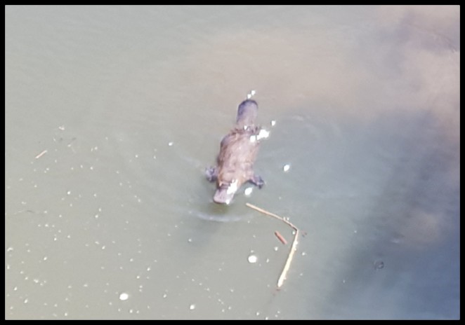
Today my luck was in. However, while a platypus surfaced many times, I found it difficult to get a photo. This is the best I could do.
While down by the dam I remembered that there was a walk from its base up to the top which I had not done previously, mainly because it used to be a straight up rock clamber. More recently a gentler, longer track (though, naturally still all up) has been opened so I decided to give it a go. To be honest, I had low expectations for this walk but as I was here I did it.
I should, at the outset, point out that the information board at the start of the walk indicates that it is a 5.5kms return walk. This is incorrect – it is 2.6kms return. I did a slight variation on the way back which would have added a couple of hundred metres to this.
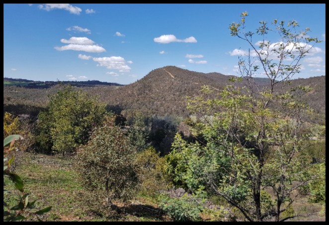
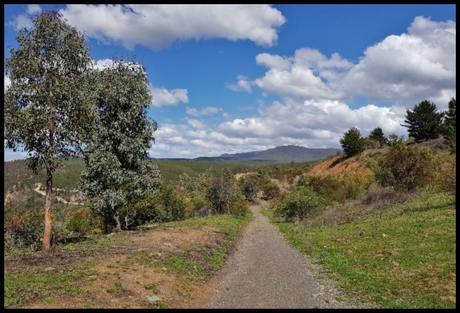
Leaving the trailhead (at the northern end of the carpark, by the foot of the dam wall) the track heads upwards and away from the dam giving good views down to the Cotter Reserve area and outwards to the Bullen Range.

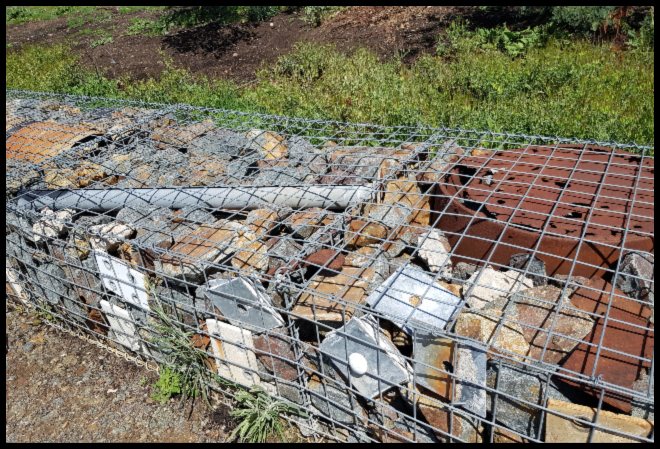
After about 650 metres, along the well maintained gravel path, I reached the half way point to the top. Here I found a small section of gabion wall containing pieces of infrastructure debris left behind after bushfires raged through the region in 2003.
While you catch your breath at this point, let me tell you a little bit about the two gentlemen to whom the track is dedicated – Alianoyonyiga (Honyong or Onyong) of the local Ngambri group and an Irish convict, Garrett Cotter.
Honyong, a very respected elder and warrior, was one of the first Aboriginals to encounter white settlers in the Tharwa/ Cotter areas. Despite the changes imposed on his land and his people Honyong showed strength and courage and, without loosing Aboriginal respect, worked for settlers on both major European stations in the Tharwa area – Cuppacumbalong and Lanyon – and formed a life-long friendship with Garrett Cotter who also worked for a number of European settlers and after whom the Cotter River (and later the Reserve and Dam) was named. This river is one of the few things in Australia named after a convict, as opposed to a voluntary settler.
Honyong was killed during a leadership fight with his old friend and countryman, Noolup (also known as Jimmy the Rover). Some accounts suggest he was shot by a European settler for stealing cattle – an activity he was quite partial too. He was buried on the hillside not far from the general store in nearby village of Tharwa. You can read a little more about Honyong in my separate Tharwa post – Onyong’s Grave.
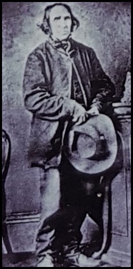
Garrett Cotter was born in Cork, Ireland, in 1802 and was deported to Australia in 1822 for “Whiteboyism” – agitating against excessive rents and the condition of peasants. Such agitation seems to have included the heinous crime of inciting a milkmaid to swear against milking cows until rebel demands were met. Romantic as this seems Cotter is also alleged to have fired on a military patrol, hence the severity of his sentence. Official ship records record his misdemeanour as ‘Insurrection and Firing on the King’s Troops’.
On arrival in Australia, Cotter was assigned to a settler at Lake George (on the Sydney side of Canberra). While there, he stole a horse leading to his second exile, to the then remote Cotter/Murrumbidgee area, to care for stock. Cotter was pardoned for his crime in 1847 and died in 1886 in the nearby village of Michelago where he and his wife were buried.
Moving on with the walk, the track now turns on itself and continues upwards, partly sealed. Soon to my left I passed a saddle dam which, like the main dam, is required to retain water in the reservoir though it lacks any of the gates or other apparatus to control the water level which the main dam has.
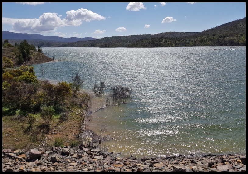
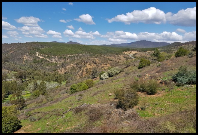
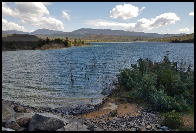
Very soon, after a glimpse of the almost full reservoir, through the security fence, I arrived at the main dam lookout which afforded a decent view of the upper reaches of the main Cotter Dam wall. I have recorded details on the dam and its role in ensuring an adequate water supply for Canberra in a separate post – Cotter Dam Discovery Trail and Dam – so will not repeat it here.


In all honesty I was a little disappointed with the lookout views and in particular the inability to see more than a snippet of the reservoir behind the dam. Had I returned via the official track I had used to get to the lookout I would have found it difficult to recommend the walk, especially given other options available in the area.
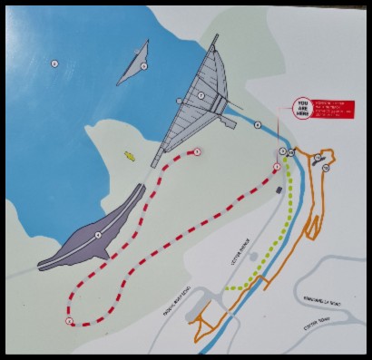
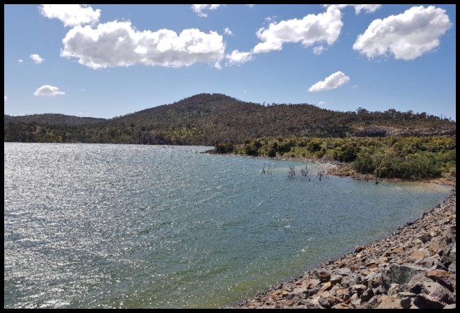
In an effort to see more of the reservoir I started my return walk by following the fence-line protecting the dam and its associated assets (and people who would invariably go too close to the wall edge, from themselves!). In so doing I unexpectedly found myself up on top of the saddle dam (see sketch map above – dark grey). Walking along the road on the saddle dam I had great views out onto the reservoir. There was nothing to indicate that I should not have taken this diversion and at no time did trespass on any restricted area.


Having crossed the saddle dam I veered left, down along a management road, to reconnect with the walking track which I followed back to the carpark, an easy downhill saunter.
With the short diversion to include a walk across the saddle dam, the walk was very well worthwhile and as such I highly recommend it, otherwise hmmmmm.
The Cotter Dam and trailhead for this walk is about 29kms (35 minutes drive) from the centre of Canberra.
My next CANBERRA – WESTON CREEK AND THE WESTERN ACT review HERE.
For other CANBERRA reviews click HERE.

what a lovely walk – fantastic seeing the platypus.
LikeLiked by 1 person
Thanks Sue. I have seen them at Cotter a few times. Higher likelihood of a a siting at Tidbinbilla though.
LikeLiked by 1 person
That looks like a really nice walk – a good mix of many views and countryside. Thanks for telling me the name of the Gabion wall technique! I have been wracking my brain forever trying to remember what they are called!
LikeLiked by 1 person
Yes, with the extension to include Saddle Dam it is very worthwhile doing. I confess I learned a new word on this walk – gabion!
LikeLiked by 1 person
Yes, I’ve learned something too – I’ve also seen gabion walls with no idea what they were called. The walk along the Saddle Reservoir certainly lifted things, I wonder why they don’t include it in the trail.
LikeLiked by 1 person
I am not sure why it is not included in the trail, Anabel, especially as I cannot imagine that it would result in a regrading of the walk to a higher level of difficulty.
LikeLiked by 1 person
I loved seeing the platypus even if you were disappointed with the photo!
LikeLiked by 1 person
We have quite a few Gabion walls around here, but I never knew what they were called.
LikeLiked by 1 person
The name was new to me too Don .
LikeLiked by 1 person