
Today we moved on from Sea Lake to the larger rural town of Kerang (population just shy of 4,000) which we will use as a base to explore the Kerang Lakes, tomorrow. Today our primary focus was the mundane activity of shopping to stock up on provisions – there being a Woolworths supermarket in town. While in town we also had a quick look around and a stroll along the Loddon River.
Our trip to Kerang took the best part of two hours passing through primarily farming country, supporting a very mixed bag of agricultural types including livestock, dairy, hay and grain, horticulture, viticulture, stone fruit, cotton, corn, and sorghum.
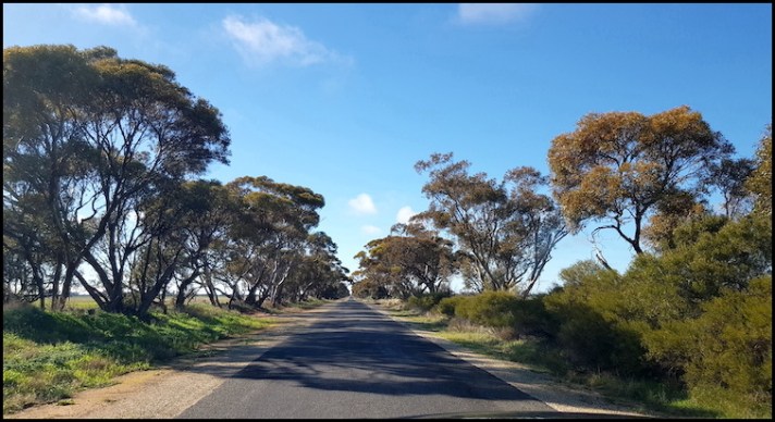
Meandering along a country road in Victoria between Sea Lake and Kerang.
En route to Kerang, we made a short detour to visit one of many peculiarly named places found right across Australia—in this case, Tittybong.
Some years ago, I wrote a review listing what some might term crass and vulgar named places in Australia – Australia – From Tittybong to Rooty Hill. I suggested that for those looking for something different to do, they could consider a road trip taking in all (for those with plenty of idle time on their hands) or some of these places. An alternative, perhaps, to the silo art or Big Things tours which many do?
Without doing any research and just seeing it marked on the map I had envisaged Tittybong as being a small settlement centred on an intersection. As we approached that intersection we passed a metal sign “Tittybong” to our right which I assumed to be the name of a local station (farm). When we got to the intersection there was absolutely nothing there. Wikipedia tells me that Tittybong had a population of three ( in 2016), presumably those living on the farm we had passed, and that there used to be a post office there which closed in 1968. I saw no trace of a post office.
So, ‘today’s Tittybong’ is presumably the station we passed. As there was nowhere convenient to turn our caravan around, I missed out on getting a photograph. The photo below is one I found online, from which I have crudely removed half a dozen people and a car – the wonders of modern technology, even if crudely applied!

On arriving into Kerang we chose to stay at the Kerang RV self contained site, courtesy of the local turf club.
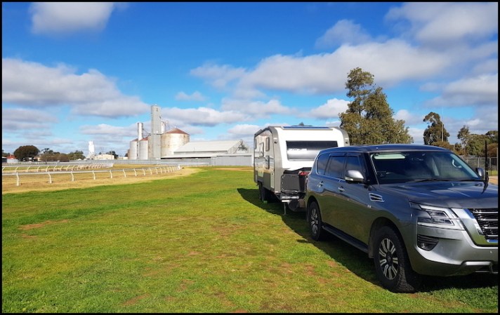
Parked up at our Kerang campsite
Lest anyone imagine Australia is all blue skies and balmy temperatures I include a picture of our van on the morning of departure from Kerang – a reminder that this section of our travels is in mid winter and we do get fogs and zero temperatures. Thankfully, we were nice and toasty inside and about an hour after the photo below was taken the blue skies, if not the balmy temperatures, returned.

Not always blue skies and balmy temperatures at 9.50am
Anyway, back to a couple of days earlier, after what was a late lunch due to our delayed departure from Sea Lake, we went into town to shop and have a look around. There, we came across many old public buildings and infrastructure dating back to the 1880s. At that time, the town emerged from previously isolated settlements and a small village to meet the growing needs of agricultural expansion in the area following the introduction of a river irrigation scheme in 1863. Incidentally, it was the first such scheme in the state of Victoria.
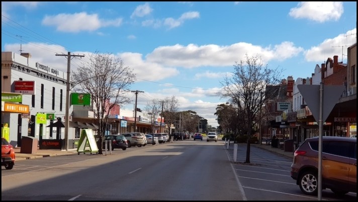
Downtown Kerang
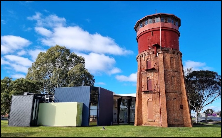
Our first port of call was the The Lester Smith Lookout Tower which was originally a water storage tower built in 1883.
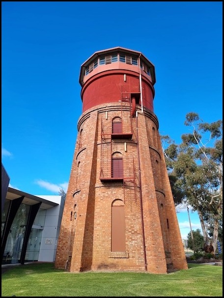
The tower was converted to a lookout in 1973. Lester Smith was a member of the Kerang Shire Council from 1932 to 1965, President of the Murray Valley League from 1956 to 1960 and chairman of Region 3 from 1950 to 1965 – clearly bestowing on him sufficient pedigree to have an abandoned water tower spruced up and named after him. While we could have got keys from the adjacent tourist office to climb up the tower we passed on the opportunity settling instead for some information on, and a map of, the Kerang Lakes area which we would explore the following day.
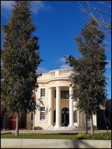
In the centre of town, located side by side, are three impressive municipal buildings, the Kerang Memorial Municipal Chambers, the Kerang Courthouse, and the Post Office.
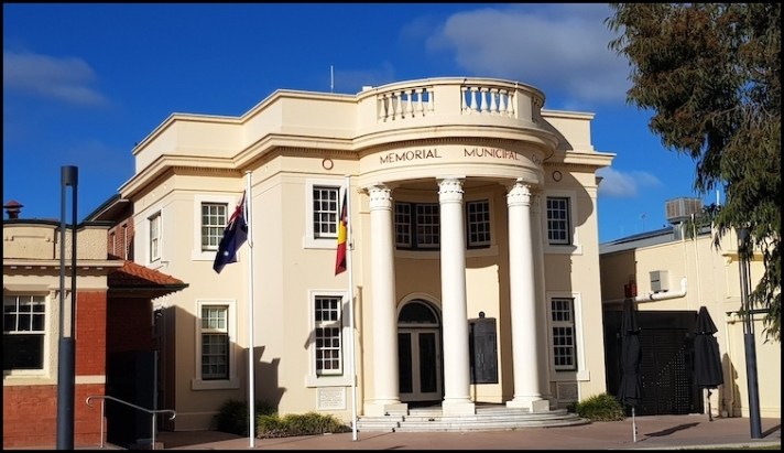
Kerang Memorial Municipal Chambers
The very impressive Kerang Memorial Municipal Chambers opened on 25th March 1927, and in addition to housing the chambers for the Gannawarra Shire Council the front of the building serves as a war memorial. In the entrance porch are four bronze tablets commemorating the local residents who served in World War One. They include the names of 175 men who never returned home from that war.
The Kerang Court House opened in 1912.
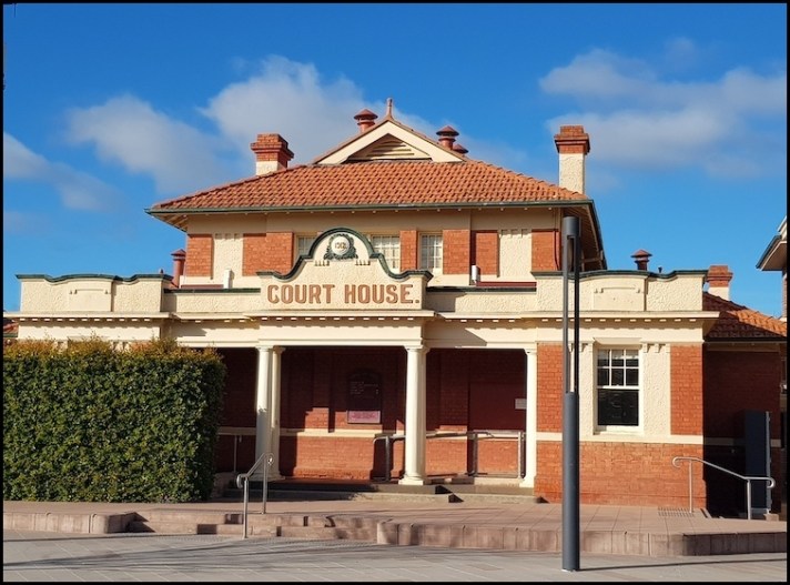
The building is an excellent example of a Victorian Court House in the Federation free style. It was built by Charles Taysom at a cost of £2,300. S.C.Brittingham was the architect.
The town’s post office was designed by the Victorian Colonial Architect, George William Watson, and was built in 1886. It was added to the Australian Commonwealth Heritage List in 2011.

The beautiful Karlie McDonald Memorial Clock at the intersection of Wellington and Victoria Streets was built in 1933 to honour a local schoolteacher, Karlie McDonald, who died in 1927 while trying to save one of her students from drowning in the town’s Loddon River.
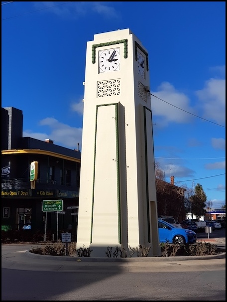
On the clock’s inauguration the Sydney Mail (13 December, 1933) reported:
“One of the most attractive features of the Victorian township of Kerang is a tall and imposing new clock obelisk that commemorates the plucky, but ill-fated, action of a local school teacher named Karlie McDonald, a lass who was drowned while saving the lives of several pupils who got into difficulties during a learn-to-swim campaign. The late Miss McDonald, an extremely popular girl in the district, was only 26 years of age when the tragedy occurred. Already she has become the departed heroine of Kerang, and the fine modern clock tower erected to her memory is pointed out as the ‘Karlie McDonald Clock.’
Unlike in most other regional towns we have visited so far on this trip there was a distinct lack of obvious street art in Kerang with the only piece I encountered being that depicted below.

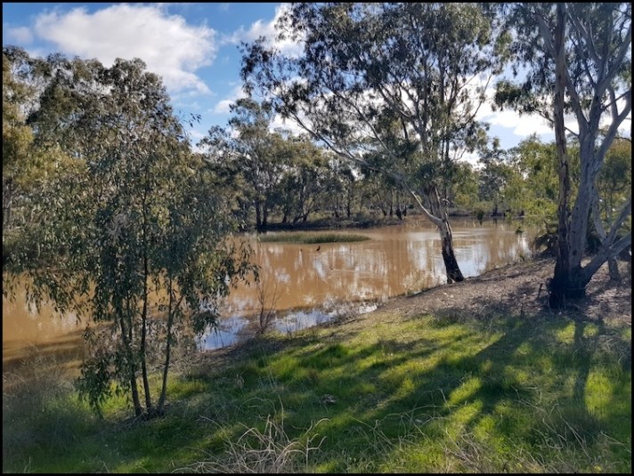
Having promenaded around town and before our Woolworths shopping expedition and calling it a day, we took a brief stroll along the picturesque banks of the town’s Loddon River. Near Kerang, the river becomes part of the Murray River floodplain, having flowed north from the southern extremities of the Great Dividing Range near Daylesford, just north of Melbourne.


The next review from my Adelaide to Canberra road trip can be found HERE.
Should you wish to follow this road trip from the beginning please start HERE.

I’m still trying to find Upotipotpon near Benalla! But my fav is Mary Smokes Creek in QLD. I have visions of a farmers wife sneaking out by the creek, wearing an apron and grabbing a quick drag on the ciggie.
LikeLiked by 1 person
A shame about the lack of street art but it looks a nice town – I do like the handsome clock! And the river scenes are pretty 🙂
LikeLiked by 1 person
Thank you Sarah … certainly not one of the most amazing towns we have stopped in but a good little stop for a break. I have to keep telling myself that we should have more days where we do bugger all.. travelling in this manner is day to day life and holiday combined.
LikeLiked by 1 person