

Today’s plan was to explore the northern part of Gunbower Island, immediately to the south of the small town of Koondrook, via a couple of walks and then have a look around the border towns of Koondrook and Barham. As mentioned in my previous entry, we were advised that our intended walks were off limits as the Gunbower Creek had flooded in early 2023 and the walking tracks were still, in late July, under water. Notwithstanding this, we made our way to the point where I had planned on starting the walks in anticipation that a some part of the tracks might be open.
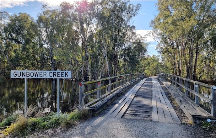
On arriving at Gunbower Creek (Koondrook Retreat, Tramway Place) we were not surprised to see that it was running very high but what did surprise us was that there were no signs indicating that the walking track from here was closed so, having looked at the creek, we headed across a footbridge to see how far we could get.
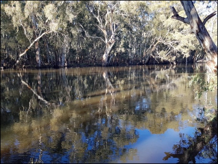
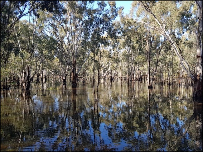
Gunbower Creek at Koondrook
Gunbower Creek at Koondrook

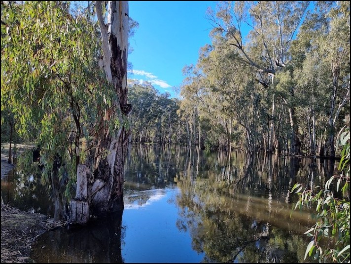
Footbridge across Gunbower Creek
About 20 metres from the end of the footbridge the track disappeared under water which signified, better than any sign could, that it was closed.

The ‘walking track continues on, somewhere behind me
On a positive note, as was the case yesterday, the wetlands had come out to meet us so no effort was necessary to see them!
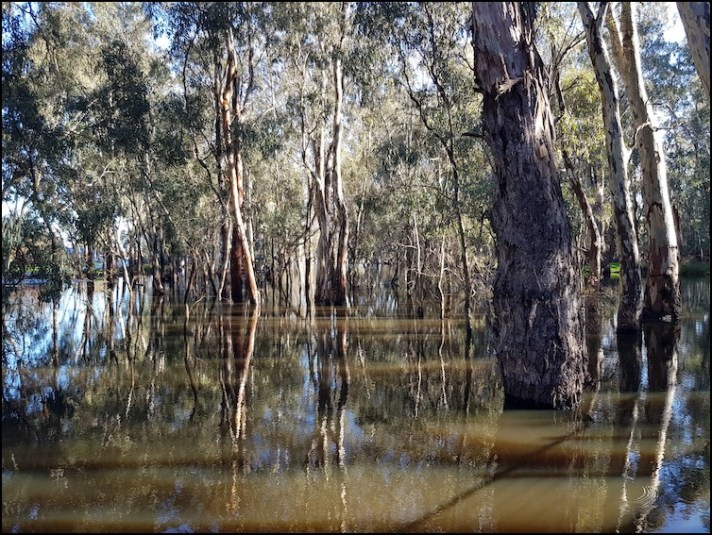
The forest area by the creek was completely inundated by water

Not able to go any further, we turned around and followed the track in the opposite direction to see how far we could go that way. After about a kilometre of walking along admiring the lower reaches of the Gunbower Creek and some massive Red Gums we arrived at the Condidorios Bridge which would take us across onto Gunbower Island, as the footbridge we had crossed earlier momentarily did.
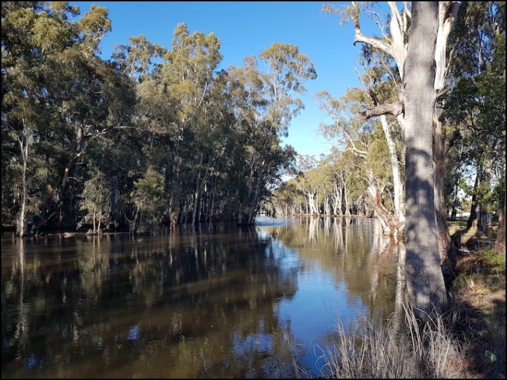
Gunbower Creek heading upstream
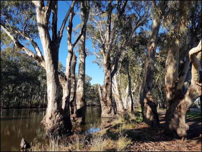
A small selection of the many beautiful Red Gums along the creek

Approaching the Coondidorios Bridge

The Coondidorious Bridge
The Coondidorios Bridge was first built in 1906 to connect the timber and farming areas of Gunbower Island to Koondrook. The mainly wooden bridge was named after a local family who owned market gardens nearby. In 2000 the bridge was taken down and reconstructed to the original design using new timber where necessary though keeping much of the original timber and ironwork.
Gunbower Island, which we had partly explored yesterday by car, is the largest inland island in Australia. It is a 26,000 hectare floodplain extending from here in Koondrook, where the Gunbower Creek rejoins the Murray River, south-easterly to the Torrumbarray Weir where water had broken away from the Murray River to form the creek and island.
Crossing the bridge we encountered floodwaters/ wetlands on either side of the road and after a few hundred metres signage told us that the walking tracks ahead were closed, bringing our walk to an end.
Though we were not able to complete any of the advertised walks we certainly were able to do sufficient to enjoy the tranquility and beauty of the forest, the creek and the floodplain.
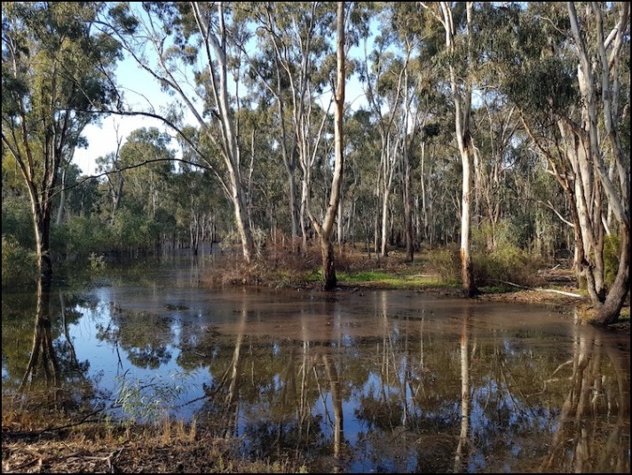
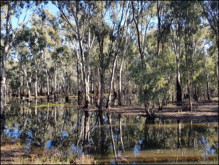
Flooded wetlands on Gunbower Island

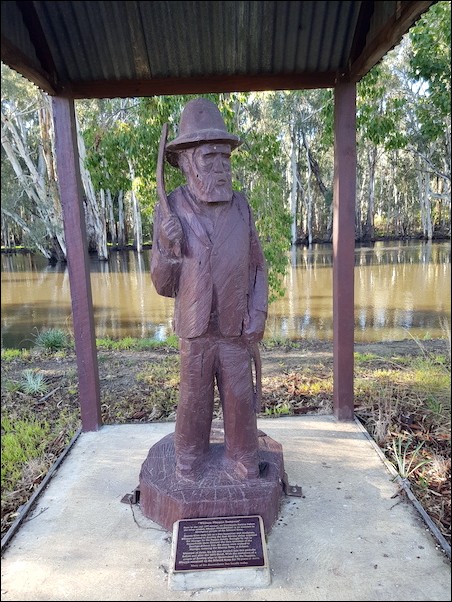
We retraced our steps planning to now have a look at about twenty (new ones are added from time to time) River Red Gum, chainsaw carved, sculptures dotted along the Murray River from where we had parked our car to the Barham – Koondrook Bridge at the other end of the town, about two kilometres away. Rather than us walking there and back Andy graciously (indeed happily!) volunteered to drive to the end of the walk and meet me there. A win-win situation, to use one of those relatively newfangled terms which I detest.
The sculptures, by world-renowned chainsaw carvers Kevin Guilders and Angela Polglaze, depict the pioneer men and women of the district along with the iconic wildlife of the area. Below are depictions of a few of them. As the sculptures are covered by shelters to protect them from the elements photographing them was difficult due to dark shadows cast by the strong morning sun.
William Nkuppa Sampson, an Aboriginal stockman who, it was said, as soon as he was able to walk could straddle a horse. While employed by the Peppin family, he drove their first merinos from Echuca to Morago and was involved in the classing and breeding of the Peppin Merino bloodline.
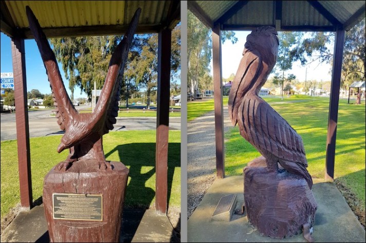
Wedge tail eagle and pelican

Murray cod
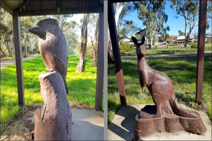
Laughing kookaburra and kangaroo
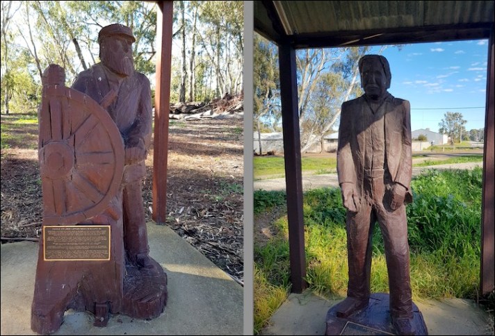
Left – Paddle steamer captain. These guys worked long hours and had an enormous knowledge of the Murray River. For many years Barham and Koondrook were important trading stops on river-boat journeys along the Murray
Right – Sir John Gorton who was born near Kangaroo Lake in the nearby Kerang Lakes area. Gorton was the 19th Prime of Australia (1968. -1971)
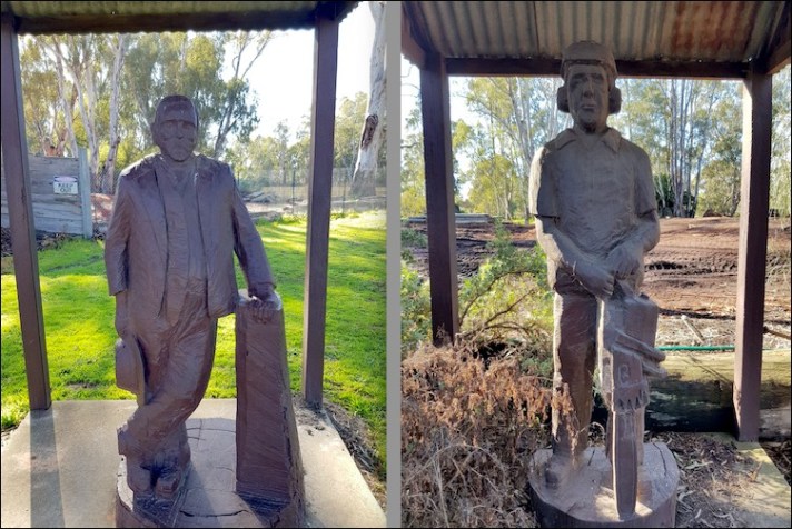
Left – Alexander ‘Sandy’ Arbuthnot founder of the Arbuthnot Sawmills – more details below
Right – A memorial sculpture to John Powell who tragically died in a tree felling accident in the Koondrook State Forest
The Arbuthnot Sawmills are located on the banks of the Murray River right in the centre of the town and, as such, I walked through part of it today.

The more historic part of the Arbuthnot Sawmills


The sawmills is a family business established by Alexander (Sandy) Arbuthnot in 1889. Sandy moved to the area in the late 1870s and with his brother Charles set up a small mill on Gunbower Island to mill local River Red Gums, then in demand as sleepers for the country’s rapidly expanding railway system. After a fallout with Charles, Sandy opened his own mill on this site in Koonbrook.
Through hard graft (he got married on Christmas Day so that he did not lose a day’s work) he expanded the business and at its peak 200 men were employed in the timber mill, a shipbuilding yard, timber felling and haulage.
In terms of shipbuilding, in addition to building paddle steamers and barges (including the ‘Koondrook’ capable of carrying 200 tons of cargo) for his own business, he built the same for others. Some of the company’s vessels are still in service, including the 1923 built “Alexander Arbuthnot” paddleboat which offers tourist trips from the Port of Echuca, our destination for tomorrow.
Outside the sawmill is a horse/bullock pulled log buggy, one of many used to transport logs to the river for subsequent transport to the sawmill, by barge.

Roads and trucks (lorries) have long since replaced the river and barges for transporting raw logs to the mill and the company’s shipbuilding activities closed many years ago. With that and automation in the timber industry more generally the company now employs only around 20 full-time employees and contractors.
Also not far from the sawmill is the former terminus of the Kerang – Koondrook Tramway which served the town between 1889 and 1977 for passengers, and 1981 for freight services – another casualty to road transport. Plans are afoot to create a Rail Trail (walking/cycling track) along the former tramway corridor to Kerang, and beyond.
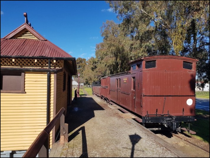
Kerang – Koondrook Tramway, Koondrook terminus
In addition to admiring the sculptures and learning about the history of the town, through them and the sawmill, I also enjoyed the river views along my walk. Before I knew it I was approaching the bridge across to Barham, in New South Wales.

The Murray River at Koondrook


The Barham – Koondrook Bridge
This bridge, designed by Sir John Monash, is one of the oldest on the Murray River. It was constructed in 1904 with a central lifting section to allow paddle steamers to pass through. From 1904 until it was mechanised in 1997 the lift section of the bridge was raised and lowered by two men using a system of pulleys and weights.
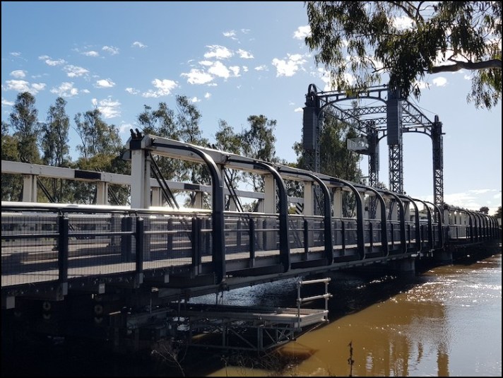

Note the high water level blocking access to the underbridge walkway
The economy of Koonbrook has traditionally relied on the timber trade, dairying and citrus fruit industries on the surrounding rich river plains of the Murray River. Of late, tourism has become popular focusing on excellent fishing for Murray cod, golden perch, carp, silver fish, catfish and yabbies, other river-based activities such as canoeing and bushwalking on Gunbower Island.
Barham, across the river, is the largest town in the Wakool Shire of New South Wales (Koondrook is in Victoria) and is the economic/commercial centre of the two towns being home to a greater selection of historic buildings, cafes and shops than Koondrook.
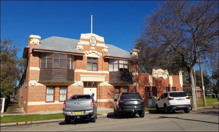
Barham War Memorial Hall which commemorates those who died in service during World War One.
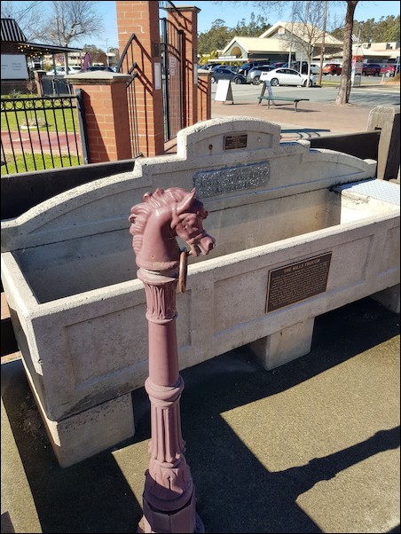
Historic horse drinking trough
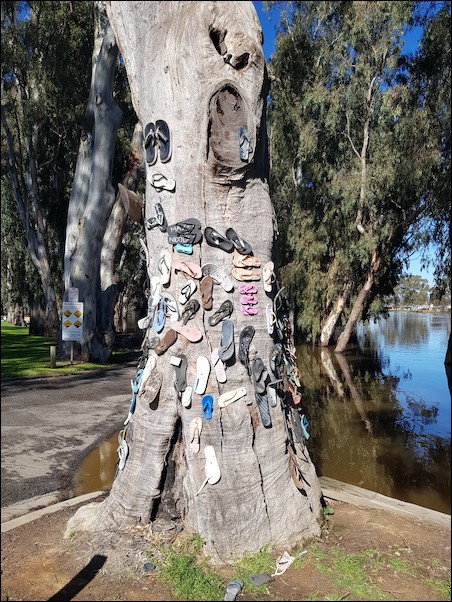
Barham ‘thong tree’ confirming the town’s place as the cultural capital of the Murray River!
We tossed up having lunch in one of Barham’s cafes but ended up heading back to Cohuna and one of the cafes there – a reasonable thing to do in light of the town providing our excellent free camp for the past three days. Tomorrow we move on to Echuca.
The next review from my Adelaide to Canberra road trip can be found HERE.
Should you wish to follow this road trip from the beginning please start HERE.

Whoops, that should have read Echuca in Victoria.
LikeLiked by 1 person
We came across a Thong Tree in Euchar during a motorhome holiday and thought it was a novel way to decorate the truck of a tree that has died. The reflections are so restful, good shots.
LikeLiked by 1 person
Thank you so much, Suzanne. We visited Echuca straight after this but missed the thong tree there so glad we saw it here!
LikeLiked by 3 people
Hopefully that trunk we saw is nourishing a new tree.
LikeLiked by 1 person
I love all the reflections in the still waters of the wetlands! And the chainsaw sculptures are an interesting way to share some of the history of this area. My favourite I think, however, is the kookaburra although to me he appears to be sulking rather than laughing 😆
LikeLiked by 1 person
Thank you Sarah the reflections are amazing. Kookaburras are beautiful birds .. I think I was about 20 years in Australia before I saw one and since then have seen many. I guess it’s hard to get detail spot on with a chainsaw!
LikeLiked by 1 person
I had to look twice to see that the Thong Tree wasn’t what I thought it was, and I couldn’t help wondering how long Sandy Arbuthnot’s marriage lasted 🙂
LikeLiked by 1 person
Haha hope I didn’t cause heart palpitations! — I was going to put flip flops (I think that’s what they are called in the UK) in brackets but decided not to lol. Sounds like Sandy was a bit of a workaholic…
LikeLiked by 1 person
Malc, I sent you a message on FB – just mentioning it here as I know you don’t use it much these days. Do you mind having a look as I would appreciate your advice on something.
LikeLiked by 1 person